
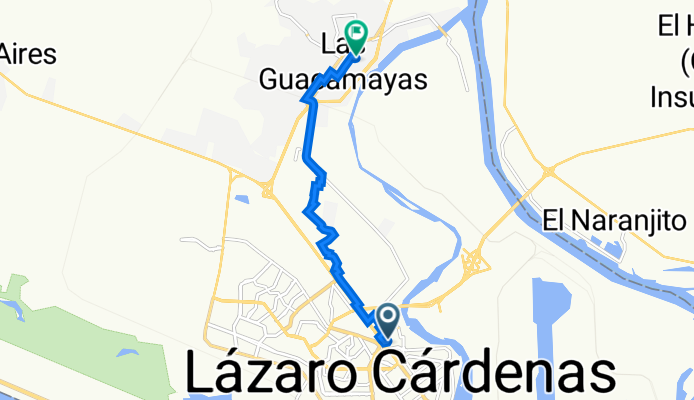
Calle Coahuila 15, Lázaro Cárdenas a Calle Guillermo Prieto 125, Las Guacamayas
A cycling route starting in Lázaro Cárdenas, Michoacán, Mexico.
Overview
About this route
- 31 min
- Duration
- 8.6 km
- Distance
- 15 m
- Ascent
- 12 m
- Descent
- 16.6 km/h
- Avg. speed
- 21 m
- Avg. speed
Route quality
Waytypes & surfaces along the route
Waytypes
Quiet road
7.4 km
(86 %)
Busy road
0.8 km
(9 %)
Surfaces
Paved
0.8 km
(9 %)
Unpaved
0.5 km
(6 %)
Asphalt
0.8 km
(9 %)
Unpaved (undefined)
0.4 km
(4 %)
Continue with Bikemap
Use, edit, or download this cycling route
You would like to ride Calle Coahuila 15, Lázaro Cárdenas a Calle Guillermo Prieto 125, Las Guacamayas or customize it for your own trip? Here is what you can do with this Bikemap route:
Free features
- Save this route as favorite or in collections
- Copy & plan your own version of this route
- Sync your route with Garmin or Wahoo
Premium features
Free trial for 3 days, or one-time payment. More about Bikemap Premium.
- Navigate this route on iOS & Android
- Export a GPX / KML file of this route
- Create your custom printout (try it for free)
- Download this route for offline navigation
Discover more Premium features.
Get Bikemap PremiumFrom our community
Other popular routes starting in Lázaro Cárdenas
 J53 – Jeudi 03 mars 2016 – Lazaro Cardenas – Caleta De Campos
- Distance
- 70.4 km
- Ascent
- 338 m
- Descent
- 333 m
- Location
- Lázaro Cárdenas, Michoacán, Mexico
 Calle Coahuila 15, Lázaro Cárdenas a Calle Guillermo Prieto 125, Las Guacamayas
- Distance
- 8.6 km
- Ascent
- 15 m
- Descent
- 12 m
- Location
- Lázaro Cárdenas, Michoacán, Mexico
 Presa
Presa- Distance
- 24.6 km
- Ascent
- 140 m
- Descent
- 139 m
- Location
- Lázaro Cárdenas, Michoacán, Mexico
 De Espigones 126, Lázaro Cárdenas a Espigones 115, Lázaro Cárdenas
- Distance
- 1 km
- Ascent
- 20 m
- Descent
- 7 m
- Location
- Lázaro Cárdenas, Michoacán, Mexico
 Mexiko Tour 11
- Distance
- 199 km
- Ascent
- 385 m
- Descent
- 363 m
- Location
- Lázaro Cárdenas, Michoacán, Mexico
 las guacamayas
- Distance
- 7.7 km
- Ascent
- 23 m
- Descent
- 20 m
- Location
- Lázaro Cárdenas, Michoacán, Mexico
 Calle Coahuila 15, Lázaro Cárdenas a Calle Francisco Sarabia, Playa Azul
- Distance
- 20.3 km
- Ascent
- 47 m
- Descent
- 49 m
- Location
- Lázaro Cárdenas, Michoacán, Mexico
 paseo vias LZC
- Distance
- 3.5 km
- Ascent
- 66 m
- Descent
- 63 m
- Location
- Lázaro Cárdenas, Michoacán, Mexico
Open it in the app