

Recovered Route
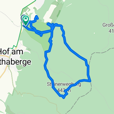
A cycling route starting in Hof am Leithaberge, Lower Austria, Austria.
Overview
About this route
- 24 min
- Duration
- 7 km
- Distance
- 54 m
- Ascent
- 83 m
- Descent
- 17.2 km/h
- Avg. speed
- 245 m
- Max. altitude

Route quality
Waytypes & surfaces along the route
Waytypes
Quiet road
2.9 km
(41 %)
Track
1.3 km
(19 %)
Surfaces
Paved
5.6 km
(80 %)
Asphalt
5.6 km
(80 %)
Undefined
1.4 km
(20 %)
Continue with Bikemap
Use, edit, or download this cycling route
You would like to ride Recovered Route or customize it for your own trip? Here is what you can do with this Bikemap route:
Free features
- Save this route as favorite or in collections
- Copy & plan your own version of this route
- Sync your route with Garmin or Wahoo
Premium features
Free trial for 3 days, or one-time payment. More about Bikemap Premium.
- Navigate this route on iOS & Android
- Export a GPX / KML file of this route
- Create your custom printout (try it for free)
- Download this route for offline navigation
Discover more Premium features.
Get Bikemap PremiumFrom our community
Other popular routes starting in Hof am Leithaberge
 Arbachmühle nach Arbachmühle
- Distance
- 16.6 km
- Ascent
- 397 m
- Descent
- 395 m
- Location
- Hof am Leithaberge, Lower Austria, Austria
 Brunnengasse 19, Hof am Leithaberge nach Brunnengasse 21, Hof am Leithaberge
- Distance
- 12.3 km
- Ascent
- 144 m
- Descent
- 146 m
- Location
- Hof am Leithaberge, Lower Austria, Austria
 Radhaus LeithaBerge Mitte Nord
- Distance
- 40.5 km
- Ascent
- 657 m
- Descent
- 657 m
- Location
- Hof am Leithaberge, Lower Austria, Austria
 Brunnengasse 19, Hof am Leithaberge nach Brunnengasse 19, Hof am Leithaberge
- Distance
- 18.2 km
- Ascent
- 396 m
- Descent
- 394 m
- Location
- Hof am Leithaberge, Lower Austria, Austria
 Föhrenweg 12–14, Hof am Leithaberge nach Brunnengasse 19, Hof am Leithaberge
- Distance
- 24 km
- Ascent
- 295 m
- Descent
- 305 m
- Location
- Hof am Leithaberge, Lower Austria, Austria
 Wüste-Donnerskirchen-Purbach-Wüste
- Distance
- 30.2 km
- Ascent
- 530 m
- Descent
- 524 m
- Location
- Hof am Leithaberge, Lower Austria, Austria
 Leithagebirge
- Distance
- 64.3 km
- Ascent
- 736 m
- Descent
- 749 m
- Location
- Hof am Leithaberge, Lower Austria, Austria
 Sonntag mittags Leithafeld Ri 2452 via WÜSTE nach Hause
- Distance
- 17.5 km
- Ascent
- 233 m
- Descent
- 197 m
- Location
- Hof am Leithaberge, Lower Austria, Austria
Open it in the app