

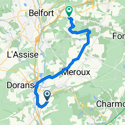
33 km 140 m de montée en boucle
A cycling route starting in Châtenois-les-Forges, Bourgogne-Franche-Comté, France.
Overview
About this route
- -:--
- Duration
- 33.1 km
- Distance
- 181 m
- Ascent
- 189 m
- Descent
- ---
- Avg. speed
- 406 m
- Max. altitude

Route quality
Waytypes & surfaces along the route
Waytypes
Cycleway
12.8 km
(39 %)
Path
9.7 km
(29 %)
Surfaces
Paved
19.2 km
(58 %)
Unpaved
0.1 km
(<1 %)
Asphalt
19 km
(57 %)
Paved (undefined)
0.2 km
(<1 %)
Continue with Bikemap
Use, edit, or download this cycling route
You would like to ride 33 km 140 m de montée en boucle or customize it for your own trip? Here is what you can do with this Bikemap route:
Free features
- Save this route as favorite or in collections
- Copy & plan your own version of this route
- Sync your route with Garmin or Wahoo
Premium features
Free trial for 3 days, or one-time payment. More about Bikemap Premium.
- Navigate this route on iOS & Android
- Export a GPX / KML file of this route
- Create your custom printout (try it for free)
- Download this route for offline navigation
Discover more Premium features.
Get Bikemap PremiumFrom our community
Other popular routes starting in Châtenois-les-Forges
 Ecot-Blamont
- Distance
- 88.7 km
- Ascent
- 893 m
- Descent
- 891 m
- Location
- Châtenois-les-Forges, Bourgogne-Franche-Comté, France
 Route de Moval, Trévenans à Rue du Tilleul, Pérouse
- Distance
- 13.6 km
- Ascent
- 115 m
- Descent
- 91 m
- Location
- Châtenois-les-Forges, Bourgogne-Franche-Comté, France
 Malsaucy A/R
- Distance
- 33.7 km
- Ascent
- 71 m
- Descent
- 68 m
- Location
- Châtenois-les-Forges, Bourgogne-Franche-Comté, France
 Dannemarie_61 km
- Distance
- 60.7 km
- Ascent
- 264 m
- Descent
- 264 m
- Location
- Châtenois-les-Forges, Bourgogne-Franche-Comté, France
 De 50 Route de Dambenois, Trévenans à 12 Rue de la Passerelle, Trévenans
- Distance
- 12.9 km
- Ascent
- 55 m
- Descent
- 90 m
- Location
- Châtenois-les-Forges, Bourgogne-Franche-Comté, France
 Bourbach le Haut
- Distance
- 77.1 km
- Ascent
- 992 m
- Descent
- 990 m
- Location
- Châtenois-les-Forges, Bourgogne-Franche-Comté, France
 Athésans-Etroitefontaine
- Distance
- 87 km
- Ascent
- 454 m
- Descent
- 452 m
- Location
- Châtenois-les-Forges, Bourgogne-Franche-Comté, France
 Fregiécourt (CH)
- Distance
- 89 km
- Ascent
- 608 m
- Descent
- 608 m
- Location
- Châtenois-les-Forges, Bourgogne-Franche-Comté, France
Open it in the app