
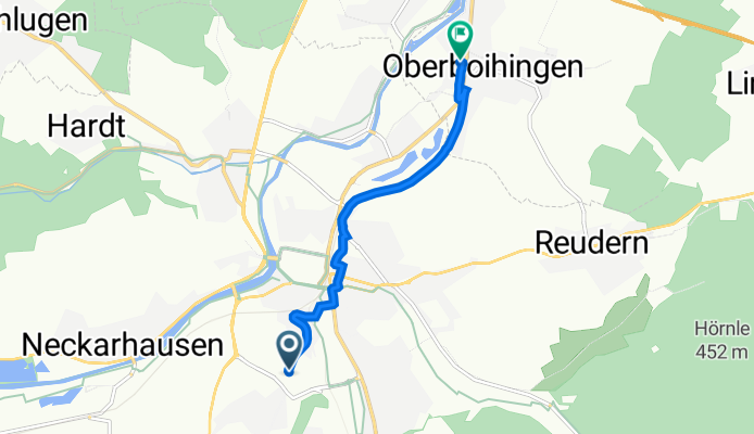
Nürtingen Auf dem Lerchenberg nach Neckarstraße 9, Oberboihingen
A cycling route starting in Nürtingen, Baden-Württemberg, Germany.
Overview
About this route
- 13 min
- Duration
- 5.4 km
- Distance
- 8 m
- Ascent
- 122 m
- Descent
- 25.8 km/h
- Avg. speed
- 385 m
- Avg. speed

Route quality
Waytypes & surfaces along the route
Waytypes
Quiet road
3.2 km
(58 %)
Track
0.9 km
(16 %)
Surfaces
Paved
4.9 km
(91 %)
Asphalt
4.7 km
(86 %)
Paved (undefined)
0.2 km
(5 %)
Undefined
0.5 km
(9 %)
Continue with Bikemap
Use, edit, or download this cycling route
You would like to ride Nürtingen Auf dem Lerchenberg nach Neckarstraße 9, Oberboihingen or customize it for your own trip? Here is what you can do with this Bikemap route:
Free features
- Save this route as favorite or in collections
- Copy & plan your own version of this route
- Sync your route with Garmin or Wahoo
Premium features
Free trial for 3 days, or one-time payment. More about Bikemap Premium.
- Navigate this route on iOS & Android
- Export a GPX / KML file of this route
- Create your custom printout (try it for free)
- Download this route for offline navigation
Discover more Premium features.
Get Bikemap PremiumFrom our community
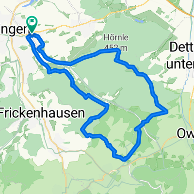
Other popular routes starting in Nürtingen
 Runde von Nürtingen, Naturpark Schönbuch, Tübingen
- Distance
- 61.9 km
- Ascent
- 468 m
- Descent
- 468 m
- Location
- Nürtingen, Baden-Württemberg, Germany
 Die Hügel von Nürtingen
- Distance
- 16.5 km
- Ascent
- 231 m
- Descent
- 231 m
- Location
- Nürtingen, Baden-Württemberg, Germany
 Nürtingen-Lämmerbuckel und zurück
- Distance
- 86.8 km
- Ascent
- 1,257 m
- Descent
- 1,183 m
- Location
- Nürtingen, Baden-Württemberg, Germany
 Engelshof
- Distance
- 43.2 km
- Ascent
- 782 m
- Descent
- 784 m
- Location
- Nürtingen, Baden-Württemberg, Germany
 nürtingen-Weiler Hütte
- Distance
- 40.7 km
- Ascent
- 303 m
- Descent
- 259 m
- Location
- Nürtingen, Baden-Württemberg, Germany
 NT Rundtour an NT beidseitig Tiefenbachtal
- Distance
- 22.6 km
- Ascent
- 410 m
- Descent
- 410 m
- Location
- Nürtingen, Baden-Württemberg, Germany
 Gerber Bräu - Hirschgarten - Reuschwald
- Distance
- 68.6 km
- Ascent
- 357 m
- Descent
- 357 m
- Location
- Nürtingen, Baden-Württemberg, Germany
 Alb-Panorama
- Distance
- 60.4 km
- Ascent
- 419 m
- Descent
- 416 m
- Location
- Nürtingen, Baden-Württemberg, Germany
Open it in the app