

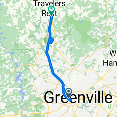
To Swamp Rabbit Trail Extension
A cycling route starting in Greenville, South Carolina, United States.
Overview
About this route
- 24 min
- Duration
- 5.5 km
- Distance
- 93 m
- Ascent
- 85 m
- Descent
- 13.9 km/h
- Avg. speed
- 315 m
- Max. altitude

Route quality
Waytypes & surfaces along the route
Waytypes
Quiet road
2.7 km
(49 %)
Road
2.3 km
(42 %)
Surfaces
Paved
4.9 km
(90 %)
Asphalt
4.1 km
(76 %)
Paved (undefined)
0.8 km
(14 %)
Undefined
0.5 km
(10 %)
Continue with Bikemap
Use, edit, or download this cycling route
You would like to ride To Swamp Rabbit Trail Extension or customize it for your own trip? Here is what you can do with this Bikemap route:
Free features
- Save this route as favorite or in collections
- Copy & plan your own version of this route
- Sync your route with Garmin or Wahoo
Premium features
Free trial for 3 days, or one-time payment. More about Bikemap Premium.
- Navigate this route on iOS & Android
- Export a GPX / KML file of this route
- Create your custom printout (try it for free)
- Download this route for offline navigation
Discover more Premium features.
Get Bikemap PremiumFrom our community
Other popular routes starting in Greenville
 107 Morningdale Dr, Greenville to 1722 N Main St, Greenville
- Distance
- 0.3 km
- Ascent
- 3 m
- Descent
- 0 m
- Location
- Greenville, South Carolina, United States
 1001 S Church St, Greenville to 107 Morningdale Dr, Greenville
- Distance
- 5.6 km
- Ascent
- 130 m
- Descent
- 113 m
- Location
- Greenville, South Carolina, United States
 107 Morningdale Dr, Greenville to 1100 S Main St, Greenville
- Distance
- 5.5 km
- Ascent
- 111 m
- Descent
- 405 m
- Location
- Greenville, South Carolina, United States
 245 Woodruff Rd, Greenville to 201 Ponders Ray Ln, Greenville
- Distance
- 53.3 km
- Ascent
- 421 m
- Descent
- 402 m
- Location
- Greenville, South Carolina, United States
 To Swamp Rabbit Trail Extension
- Distance
- 5.5 km
- Ascent
- 93 m
- Descent
- 85 m
- Location
- Greenville, South Carolina, United States
 Greenville to Swamp Rabbit Trail, Travelers Rest
- Distance
- 16.6 km
- Ascent
- 173 m
- Descent
- 117 m
- Location
- Greenville, South Carolina, United States
 209–299 Howe St, Greenville to 200 University Ridge, Greenville
- Distance
- 40.7 km
- Ascent
- 605 m
- Descent
- 601 m
- Location
- Greenville, South Carolina, United States
 31 Augusta St, Greenville to 301 River St, Greenville
- Distance
- 1.7 km
- Ascent
- 21 m
- Descent
- 19 m
- Location
- Greenville, South Carolina, United States
Open it in the app