

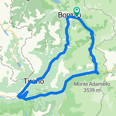
Bormio nach Viale Catullo 44, Manerba del Garda
A cycling route starting in San Nicolò, Lombardy, Italy.
Overview
About this route
- 21 h 9 min
- Duration
- 251.1 km
- Distance
- 4,875 m
- Ascent
- 7,543 m
- Descent
- 11.9 km/h
- Avg. speed
- 2,762 m
- Max. altitude
Route quality
Waytypes & surfaces along the route
Waytypes
Quiet road
68 km
(27 %)
Cycleway
60.7 km
(24 %)
Surfaces
Paved
148 km
(59 %)
Unpaved
18.8 km
(8 %)
Asphalt
133.7 km
(53 %)
Paved (undefined)
12.7 km
(5 %)
Continue with Bikemap
Use, edit, or download this cycling route
You would like to ride Bormio nach Viale Catullo 44, Manerba del Garda or customize it for your own trip? Here is what you can do with this Bikemap route:
Free features
- Save this route as favorite or in collections
- Copy & plan your own version of this route
- Split it into stages to create a multi-day tour
- Sync your route with Garmin or Wahoo
Premium features
Free trial for 3 days, or one-time payment. More about Bikemap Premium.
- Navigate this route on iOS & Android
- Export a GPX / KML file of this route
- Create your custom printout (try it for free)
- Download this route for offline navigation
Discover more Premium features.
Get Bikemap PremiumFrom our community
Other popular routes starting in San Nicolò
 Etape 1 - Stelvio
- Distance
- 64.7 km
- Ascent
- 1,844 m
- Descent
- 1,842 m
- Location
- San Nicolò, Lombardy, Italy
 Valfurva - Gavia - Ponte di Legno - Monno - Edolo - Aprica - Tirano - Grosio - Bormio - Valfurva
- Distance
- 143.5 km
- Ascent
- 3,439 m
- Descent
- 3,439 m
- Location
- San Nicolò, Lombardy, Italy
 Bormio-Passo Stelvio (Cima)-Passo Umbrail-Sta Maria Val Müstair-Prato allo Stelvio-Trafoi-Passo Stelvio-Bormio
- Distance
- 109.8 km
- Ascent
- 3,418 m
- Descent
- 3,373 m
- Location
- San Nicolò, Lombardy, Italy
 Bormio nach Viale Catullo 44, Manerba del Garda
- Distance
- 251.1 km
- Ascent
- 4,875 m
- Descent
- 7,543 m
- Location
- San Nicolò, Lombardy, Italy
 Stelvio Pass to Innsbruck
- Distance
- 176 km
- Ascent
- 1,344 m
- Descent
- 3,487 m
- Location
- San Nicolò, Lombardy, Italy
 Umbrailtrail
- Distance
- 9.1 km
- Ascent
- 14 m
- Descent
- 1,106 m
- Location
- San Nicolò, Lombardy, Italy
 Park Nazionale-Umbrail Pass-Sta.Maria-Prato-Stelvio-Passo Stelvio-Park Nazionale
- Distance
- 87 km
- Ascent
- 2,260 m
- Descent
- 3,109 m
- Location
- San Nicolò, Lombardy, Italy
 Bormio -Stelvio
- Distance
- 25.7 km
- Ascent
- 1,403 m
- Descent
- 618 m
- Location
- San Nicolò, Lombardy, Italy
Open it in the app