Groby w Puszczy
A cycling route starting in Niepołomice, Lesser Poland Voivodeship, Poland.
Overview
About this route
- -:--
- Duration
- 53.6 km
- Distance
- 110 m
- Ascent
- 112 m
- Descent
- ---
- Avg. speed
- ---
- Max. altitude
Route highlights
Points of interest along the route

Point of interest after 2 km
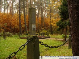
Mogiła żydowska na Kozich Górkach

Point of interest after 2.4 km
Mogiła pomordowanych na Kozich Górkach

Point of interest after 6.9 km
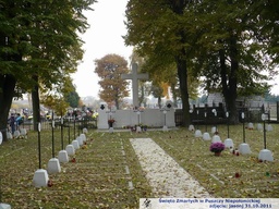
Cmentarz nr 325 na Sitowcu

Point of interest after 22.4 km
Cmentarz wojenny nr 323 w Mikluszowicach

Point of interest after 23.4 km
Pomnik Szarandy w Gawłówku

Point of interest after 27.9 km
Cmentarz żydowski w Baczkowie

Point of interest after 35.3 km
Cmentarz na Osikówce

Point of interest after 44.5 km
Pomnik w Szarowie

Point of interest after 51.4 km
Cmentarz nr 329 w Podborzu (Niepołomice)

Point of interest after 53.3 km
Cmentarz nr 327 w Niepołomicach
Continue with Bikemap
Use, edit, or download this cycling route
You would like to ride Groby w Puszczy or customize it for your own trip? Here is what you can do with this Bikemap route:
Free features
- Save this route as favorite or in collections
- Copy & plan your own version of this route
- Sync your route with Garmin or Wahoo
Premium features
Free trial for 3 days, or one-time payment. More about Bikemap Premium.
- Navigate this route on iOS & Android
- Export a GPX / KML file of this route
- Create your custom printout (try it for free)
- Download this route for offline navigation
Discover more Premium features.
Get Bikemap PremiumFrom our community
Other popular routes starting in Niepołomice
 Groby w Puszczy
- Distance
- 53.6 km
- Ascent
- 110 m
- Descent
- 112 m
- Location
- Niepołomice, Lesser Poland Voivodeship, Poland
 Niepołomice-Brzegi-Niepołomice
- Distance
- 23.5 km
- Ascent
- 30 m
- Descent
- 27 m
- Location
- Niepołomice, Lesser Poland Voivodeship, Poland
 Niepołomice do Pałacu Żeleńskich
- Distance
- 25.3 km
- Ascent
- 169 m
- Descent
- 171 m
- Location
- Niepołomice, Lesser Poland Voivodeship, Poland
 niepo
niepo- Distance
- 57.9 km
- Ascent
- 168 m
- Descent
- 168 m
- Location
- Niepołomice, Lesser Poland Voivodeship, Poland
 Niepolomice-55 km
- Distance
- 54.2 km
- Ascent
- 125 m
- Descent
- 124 m
- Location
- Niepołomice, Lesser Poland Voivodeship, Poland
 Niepołomice - Szarów - Kłaj - Poszyna - Niepolomice
- Distance
- 18.7 km
- Ascent
- 72 m
- Descent
- 76 m
- Location
- Niepołomice, Lesser Poland Voivodeship, Poland
 Puszcza Niepołomicka 1
- Distance
- 26.7 km
- Ascent
- 81 m
- Descent
- 81 m
- Location
- Niepołomice, Lesser Poland Voivodeship, Poland
 Niepołomice - Przypasek Rusiecki
- Distance
- 16.3 km
- Ascent
- 423 m
- Descent
- 477 m
- Location
- Niepołomice, Lesser Poland Voivodeship, Poland
Open it in the app

