

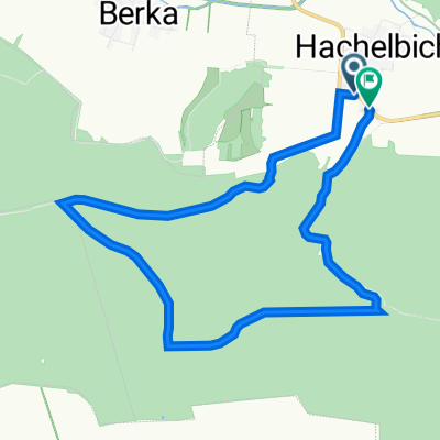
Trebra -Gebesee - Tonna
A cycling route starting in Trebra, Thuringia, Germany.
Overview
About this route
- 5 h 54 min
- Duration
- 115.4 km
- Distance
- 732 m
- Ascent
- 788 m
- Descent
- 19.6 km/h
- Avg. speed
- 318 m
- Max. altitude

Route quality
Waytypes & surfaces along the route
Waytypes
Road
69.1 km
(60 %)
Busy road
15.9 km
(14 %)
Surfaces
Paved
82.8 km
(72 %)
Unpaved
1.8 km
(2 %)
Asphalt
81.5 km
(71 %)
Ground
1.2 km
(1 %)
Continue with Bikemap
Use, edit, or download this cycling route
You would like to ride Trebra -Gebesee - Tonna or customize it for your own trip? Here is what you can do with this Bikemap route:
Free features
- Save this route as favorite or in collections
- Copy & plan your own version of this route
- Split it into stages to create a multi-day tour
- Sync your route with Garmin or Wahoo
Premium features
Free trial for 3 days, or one-time payment. More about Bikemap Premium.
- Navigate this route on iOS & Android
- Export a GPX / KML file of this route
- Create your custom printout (try it for free)
- Download this route for offline navigation
Discover more Premium features.
Get Bikemap PremiumFrom our community
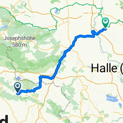
Other popular routes starting in Trebra
 Feldstraße 32, Kyffhäuserland nach L 2290, Kyffhäuserland
- Distance
- 11.7 km
- Ascent
- 192 m
- Descent
- 199 m
- Location
- Trebra, Thuringia, Germany
 Trebra -Gebesee - Tonna
- Distance
- 115.4 km
- Ascent
- 732 m
- Descent
- 788 m
- Location
- Trebra, Thuringia, Germany
 Vitalis-Keil-Straße 6A, Trebra nach Am Schulplatz 24, Kindelbrück
- Distance
- 41.1 km
- Ascent
- 463 m
- Descent
- 567 m
- Location
- Trebra, Thuringia, Germany
 08.07. Großvargula
- Distance
- 24.2 km
- Ascent
- 387 m
- Descent
- 514 m
- Location
- Trebra, Thuringia, Germany
 Langsame Fahrt in Kyffhäuserland
- Distance
- 4.1 km
- Ascent
- 33 m
- Descent
- 27 m
- Location
- Trebra, Thuringia, Germany
 Trebra - Peißen
- Distance
- 96.5 km
- Ascent
- 725 m
- Descent
- 831 m
- Location
- Trebra, Thuringia, Germany
 Vitalis-Keil-Straße 6A, Trebra nach Mühlen 6, Kyffhäuserland
- Distance
- 26.3 km
- Ascent
- 272 m
- Descent
- 370 m
- Location
- Trebra, Thuringia, Germany
Open it in the app