

Recovered Route
A cycling route starting in Wellingborough, England, United Kingdom.
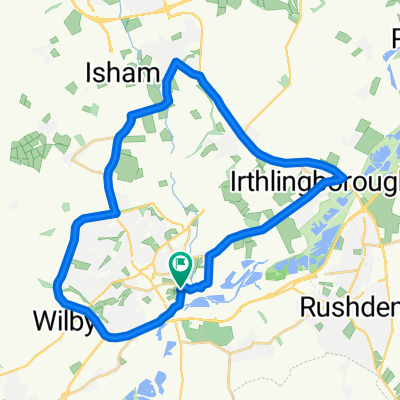
Overview
About this route
- 55 min
- Duration
- 10.1 km
- Distance
- 113 m
- Ascent
- 112 m
- Descent
- 11 km/h
- Avg. speed
- 84 m
- Max. altitude
Continue with Bikemap
Use, edit, or download this cycling route
You would like to ride Recovered Route or customize it for your own trip? Here is what you can do with this Bikemap route:
Free features
- Save this route as favorite or in collections
- Copy & plan your own version of this route
- Sync your route with Garmin or Wahoo
Premium features
Free trial for 3 days, or one-time payment. More about Bikemap Premium.
- Navigate this route on iOS & Android
- Export a GPX / KML file of this route
- Create your custom printout (try it for free)
- Download this route for offline navigation
Discover more Premium features.
Get Bikemap PremiumFrom our community
Other popular routes starting in Wellingborough
 Yelden, Raunds Loop
- Distance
- 53.9 km
- Ascent
- 243 m
- Descent
- 243 m
- Location
- Wellingborough, England, United Kingdom
 Talbot Road 87 to Northampton Road 193
- Distance
- 21.3 km
- Ascent
- 195 m
- Descent
- 190 m
- Location
- Wellingborough, England, United Kingdom
 Recording from 20 września, 18:05
- Distance
- 10.1 km
- Ascent
- 70 m
- Descent
- 70 m
- Location
- Wellingborough, England, United Kingdom
 Hardwick Circular No 01
- Distance
- 31.4 km
- Ascent
- 201 m
- Descent
- 198 m
- Location
- Wellingborough, England, United Kingdom
 Grans
Grans- Distance
- 33.1 km
- Ascent
- 414 m
- Descent
- 367 m
- Location
- Wellingborough, England, United Kingdom
 Hardwick Sywell Sprint
- Distance
- 18.6 km
- Ascent
- 85 m
- Descent
- 85 m
- Location
- Wellingborough, England, United Kingdom
 Wellingborough, Irthlingborough, Finedon, BurtonLatimer, Wellingborough
- Distance
- 28.5 km
- Ascent
- 214 m
- Descent
- 215 m
- Location
- Wellingborough, England, United Kingdom
 northant villages round kettering and welli
- Distance
- 38.5 km
- Ascent
- 253 m
- Descent
- 257 m
- Location
- Wellingborough, England, United Kingdom
Open it in the app