

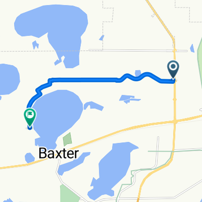
Recovered Route
A cycling route starting in Brainerd, Minnesota, United States.
Overview
About this route
- 1 h 19 min
- Duration
- 21.6 km
- Distance
- 108 m
- Ascent
- 101 m
- Descent
- 16.3 km/h
- Avg. speed
- 385 m
- Max. altitude
Route quality
Waytypes & surfaces along the route
Waytypes
Cycleway
21.6 km
(100 %)
Surfaces
Paved
21.4 km
(99 %)
Asphalt
21.4 km
(99 %)
Undefined
0.2 km
(1 %)
Continue with Bikemap
Use, edit, or download this cycling route
You would like to ride Recovered Route or customize it for your own trip? Here is what you can do with this Bikemap route:
Free features
- Save this route as favorite or in collections
- Copy & plan your own version of this route
- Sync your route with Garmin or Wahoo
Premium features
Free trial for 3 days, or one-time payment. More about Bikemap Premium.
- Navigate this route on iOS & Android
- Export a GPX / KML file of this route
- Create your custom printout (try it for free)
- Download this route for offline navigation
Discover more Premium features.
Get Bikemap PremiumFrom our community
Other popular routes starting in Brainerd
 DK Mississippi 6
- Distance
- 36.8 km
- Ascent
- 100 m
- Descent
- 76 m
- Location
- Brainerd, Minnesota, United States
 510 Laurel St, Brainerd to 301 Minnesota Ave W, Walker
- Distance
- 101.6 km
- Ascent
- 159 m
- Descent
- 122 m
- Location
- Brainerd, Minnesota, United States
 Kirkwood Ln, Baxter to Travine Dr, Baxter
- Distance
- 5.8 km
- Ascent
- 7 m
- Descent
- 4 m
- Location
- Brainerd, Minnesota, United States
 zur Hockeyhalle
- Distance
- 30.5 km
- Ascent
- 307 m
- Descent
- 292 m
- Location
- Brainerd, Minnesota, United States
 Paul Bunyan Trail
- Distance
- 152.5 km
- Ascent
- 186 m
- Descent
- 138 m
- Location
- Brainerd, Minnesota, United States
 GULL-QEQUOT-BREEZY-HOME
- Distance
- 95.2 km
- Ascent
- 190 m
- Descent
- 198 m
- Location
- Brainerd, Minnesota, United States
 Recovered Route
- Distance
- 21.6 km
- Ascent
- 108 m
- Descent
- 101 m
- Location
- Brainerd, Minnesota, United States
 Lake Tour
- Distance
- 68.7 km
- Ascent
- 196 m
- Descent
- 195 m
- Location
- Brainerd, Minnesota, United States
Open it in the app