

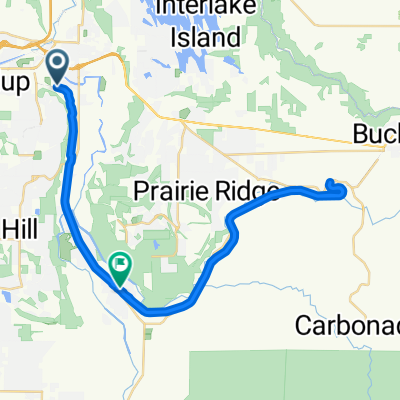
80th Street East 13810, Puyallup to Foothills Trail, Orting
A cycling route starting in Alderton, Washington, United States.
Overview
About this route
- 1 h 25 min
- Duration
- 16.5 km
- Distance
- 51 m
- Ascent
- 3 m
- Descent
- 11.6 km/h
- Avg. speed
- 70 m
- Max. altitude
Nutnicha Nigon

created this 2 years ago
Route photos


Route quality
Waytypes & surfaces along the route
Waytypes
Cycleway
16.1 km
(98 %)
Quiet road
0.2 km
(1 %)
Pedestrian area
0.2 km
(1 %)
Surfaces
Paved
16.1 km
(98 %)
Asphalt
16.1 km
(98 %)
Undefined
0.3 km
(2 %)
Continue with Bikemap
Use, edit, or download this cycling route
You would like to ride 80th Street East 13810, Puyallup to Foothills Trail, Orting or customize it for your own trip? Here is what you can do with this Bikemap route:
Free features
- Save this route as favorite or in collections
- Copy & plan your own version of this route
- Sync your route with Garmin or Wahoo
Premium features
Free trial for 3 days, or one-time payment. More about Bikemap Premium.
- Navigate this route on iOS & Android
- Export a GPX / KML file of this route
- Create your custom printout (try it for free)
- Download this route for offline navigation
Discover more Premium features.
Get Bikemap PremiumFrom our community
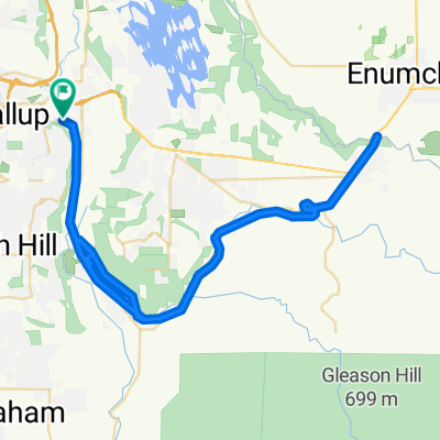
Other popular routes starting in Alderton
- 80th Street East 13902, Puyallup to 80th Street East 13902, Puyallup
- 29.6 km
- 87 m
- 88 m
- Alderton, Washington, United States
- 96th Street East
- 13.4 km
- 27 m
- 28 m
- Alderton, Washington, United States
- Work Commute
- 20.6 km
- 143 m
- 149 m
- Alderton, Washington, United States
- Foothills Trail, Puyallup to bridge, return, partA
- 43.9 km
- 193 m
- 139 m
- Alderton, Washington, United States
- Puyallup to Buckley, return
- 70.6 km
- 263 m
- 248 m
- Alderton, Washington, United States
- Sound Family Medicine Tour
- 76.8 km
- 408 m
- 416 m
- Alderton, Washington, United States


Open it in the app