

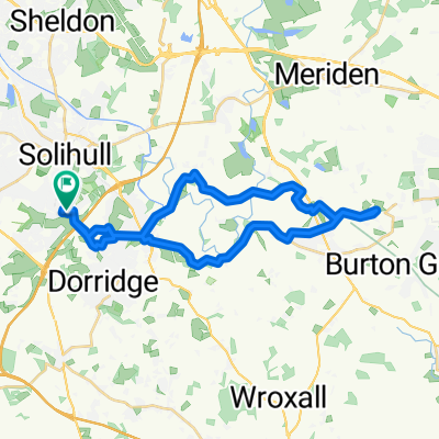
Solihull-Shirley School road
A cycling route starting in Solihull, England, United Kingdom.
Overview
About this route
- 26 min
- Duration
- 6.6 km
- Distance
- 27 m
- Ascent
- 15 m
- Descent
- 15.1 km/h
- Avg. speed
- 146 m
- Max. altitude
Route quality
Waytypes & surfaces along the route
Waytypes
Quiet road
1.4 km
(22 %)
Road
1.1 km
(17 %)
Surfaces
Paved
2.4 km
(36 %)
Asphalt
2 km
(31 %)
Paved (undefined)
0.3 km
(5 %)
Undefined
4.2 km
(64 %)
Continue with Bikemap
Use, edit, or download this cycling route
You would like to ride Solihull-Shirley School road or customize it for your own trip? Here is what you can do with this Bikemap route:
Free features
- Save this route as favorite or in collections
- Copy & plan your own version of this route
- Sync your route with Garmin or Wahoo
Premium features
Free trial for 3 days, or one-time payment. More about Bikemap Premium.
- Navigate this route on iOS & Android
- Export a GPX / KML file of this route
- Create your custom printout (try it for free)
- Download this route for offline navigation
Discover more Premium features.
Get Bikemap PremiumFrom our community
Other popular routes starting in Solihull
 Solihull-Shirley School road
- Distance
- 6.6 km
- Ascent
- 27 m
- Descent
- 15 m
- Location
- Solihull, England, United Kingdom
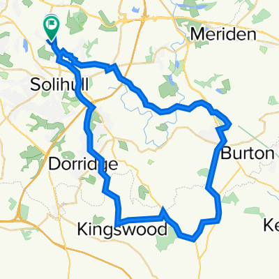
 extended ride
- Distance
- 65.9 km
- Ascent
- 206 m
- Descent
- 210 m
- Location
- Solihull, England, United Kingdom
 Easter Sunday ride
- Distance
- 46.8 km
- Ascent
- 197 m
- Descent
- 206 m
- Location
- Solihull, England, United Kingdom
 packwood and lakes
- Distance
- 25.6 km
- Ascent
- 203 m
- Descent
- 202 m
- Location
- Solihull, England, United Kingdom
 Solihull to Balsall Common
- Distance
- 28.7 km
- Ascent
- 166 m
- Descent
- 164 m
- Location
- Solihull, England, United Kingdom
 April 2019
- Distance
- 39.5 km
- Ascent
- 181 m
- Descent
- 182 m
- Location
- Solihull, England, United Kingdom
 2020 38km
- Distance
- 38.2 km
- Ascent
- 182 m
- Descent
- 179 m
- Location
- Solihull, England, United Kingdom
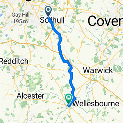 Solihull to Stratford
- Distance
- 32.3 km
- Ascent
- 144 m
- Descent
- 237 m
- Location
- Solihull, England, United Kingdom
Open it in the app