

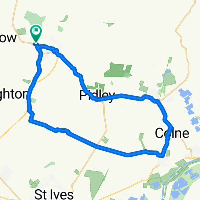
High Street 15A, Warboys to High Street 15A, Warboys
A cycling route starting in Warboys, England, United Kingdom.
Overview
About this route
- 1 h 41 min
- Duration
- 33.8 km
- Distance
- 68 m
- Ascent
- 118 m
- Descent
- 20 km/h
- Avg. speed
- 78 m
- Max. altitude

Route quality
Waytypes & surfaces along the route
Waytypes
Road
12.2 km
(36 %)
Quiet road
2.4 km
(7 %)
Surfaces
Paved
2 km
(6 %)
Asphalt
2 km
(6 %)
Undefined
31.8 km
(94 %)
Continue with Bikemap
Use, edit, or download this cycling route
You would like to ride High Street 15A, Warboys to High Street 15A, Warboys or customize it for your own trip? Here is what you can do with this Bikemap route:
Free features
- Save this route as favorite or in collections
- Copy & plan your own version of this route
- Sync your route with Garmin or Wahoo
Premium features
Free trial for 3 days, or one-time payment. More about Bikemap Premium.
- Navigate this route on iOS & Android
- Export a GPX / KML file of this route
- Create your custom printout (try it for free)
- Download this route for offline navigation
Discover more Premium features.
Get Bikemap PremiumFrom our community
Other popular routes starting in Warboys
 Haycroft Close, Huntingdon to 1 Pathfinder Way, Huntingdon
- Distance
- 37.3 km
- Ascent
- 30 m
- Descent
- 30 m
- Location
- Warboys, England, United Kingdom
 Warboy's Drains
- Distance
- 51.1 km
- Ascent
- 56 m
- Descent
- 56 m
- Location
- Warboys, England, United Kingdom
 Haycroft Close, Huntingdon to 1 Pathfinder Way, Huntingdon
- Distance
- 63.9 km
- Ascent
- 50 m
- Descent
- 50 m
- Location
- Warboys, England, United Kingdom
 Warboys-Longstanton-Warboys
- Distance
- 40.2 km
- Ascent
- 84 m
- Descent
- 85 m
- Location
- Warboys, England, United Kingdom
 Restful route in Huntingdon
- Distance
- 23.9 km
- Ascent
- 71 m
- Descent
- 69 m
- Location
- Warboys, England, United Kingdom
 1 Pathfinder Way, Huntingdon to 11 High Street, Huntingdon
- Distance
- 15.5 km
- Ascent
- 0 m
- Descent
- 20 m
- Location
- Warboys, England, United Kingdom
 Ramseys Crippled Eight
- Distance
- 43.3 km
- Ascent
- 68 m
- Descent
- 71 m
- Location
- Warboys, England, United Kingdom
 Warboys-Thorney-Warboys
- Distance
- 63.8 km
- Ascent
- 86 m
- Descent
- 86 m
- Location
- Warboys, England, United Kingdom
Open it in the app