

Lautertal-Route 2
A cycling route starting in Gomadingen, Baden-Wurttemberg, Germany.
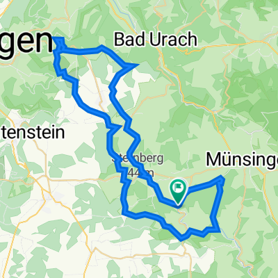
Overview
About this route
Starting point Dapfen-Marbach-Bremelau-Granheim-Anhausen
- -:--
- Duration
- 51.2 km
- Distance
- 783 m
- Ascent
- 784 m
- Descent
- ---
- Avg. speed
- 766 m
- Max. altitude

Route quality
Waytypes & surfaces along the route
Waytypes
Track
24.6 km
(48 %)
Quiet road
13.3 km
(26 %)
Surfaces
Paved
29.2 km
(57 %)
Unpaved
13.3 km
(26 %)
Asphalt
28.7 km
(56 %)
Gravel
9.2 km
(18 %)
Continue with Bikemap
Use, edit, or download this cycling route
You would like to ride Lautertal-Route 2 or customize it for your own trip? Here is what you can do with this Bikemap route:
Free features
- Save this route as favorite or in collections
- Copy & plan your own version of this route
- Sync your route with Garmin or Wahoo
Premium features
Free trial for 3 days, or one-time payment. More about Bikemap Premium.
- Navigate this route on iOS & Android
- Export a GPX / KML file of this route
- Create your custom printout (try it for free)
- Download this route for offline navigation
Discover more Premium features.
Get Bikemap PremiumFrom our community
Other popular routes starting in Gomadingen
 Von Hohenstein bis Lauterach
- Distance
- 33.4 km
- Ascent
- 917 m
- Descent
- 1,104 m
- Location
- Gomadingen, Baden-Wurttemberg, Germany
 Lautertal-Route 2
- Distance
- 51.2 km
- Ascent
- 783 m
- Descent
- 784 m
- Location
- Gomadingen, Baden-Wurttemberg, Germany
 Herbstrunde St. Johann mit Armin
- Distance
- 28.5 km
- Ascent
- 258 m
- Descent
- 260 m
- Location
- Gomadingen, Baden-Wurttemberg, Germany
 Hohenstein nach Salem
- Distance
- 94.9 km
- Ascent
- 873 m
- Descent
- 1,187 m
- Location
- Gomadingen, Baden-Wurttemberg, Germany
 Marbacher Gestütsradweg
- Distance
- 57.5 km
- Ascent
- 789 m
- Descent
- 794 m
- Location
- Gomadingen, Baden-Wurttemberg, Germany
 Rdstrk. Gächingen, Marbach, Wasserstetten
- Distance
- 45.6 km
- Ascent
- 381 m
- Descent
- 381 m
- Location
- Gomadingen, Baden-Wurttemberg, Germany
 Route in Hohenstein
- Distance
- 67.1 km
- Ascent
- 1,441 m
- Descent
- 1,438 m
- Location
- Gomadingen, Baden-Wurttemberg, Germany
 Leutkirch Trip
- Distance
- 109.9 km
- Ascent
- 1,267 m
- Descent
- 1,287 m
- Location
- Gomadingen, Baden-Wurttemberg, Germany
Open it in the app