

Weil-Hainich(2)
A cycling route starting in Erligheim, Baden-Wurttemberg, Germany.
Overview
About this route
Strecke von Erligheim, Bönnigheim, Botenheim, Brackenheim, Nordheim, Klingenberg, Heilbronn, (ab hier Neckarradweg) Bad Wimpfen, Neckarmühlbach, Haßmersheim, Neckarzimmern, Neckarlz, (ab hier Elz-Radweg) Mosbach, (ab hier Strecke der Wanderbahn), Limbach, Mudau, Uenglert, Buch, Amorbach (Mud), (ab hier Limes-Radweg) Weilbach, Miltenberg, (ab hier Mainradweg) Bürgstadt, Freudenberg, Kirschfurt, Collenberg, Dorfprozelten, Statprozelten, Faulbach, Hasloch (Eisenbahnbrücke), Bestenheide, Wertheim
ollenberg, Fechenbach, Dorfprozelten, Stadtprozelten, Faulbach, Bestenheid, Wertheim.
- -:--
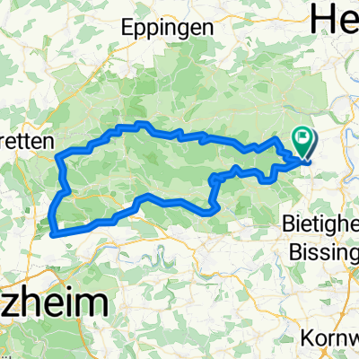
- Duration
- 146.9 km
- Distance
- 390 m
- Ascent
- 492 m
- Descent
- ---
- Avg. speed
- ---
- Max. altitude

Continue with Bikemap
Use, edit, or download this cycling route
You would like to ride Weil-Hainich(2) or customize it for your own trip? Here is what you can do with this Bikemap route:
Free features
- Save this route as favorite or in collections
- Copy & plan your own version of this route
- Split it into stages to create a multi-day tour
- Sync your route with Garmin or Wahoo
Premium features
Free trial for 3 days, or one-time payment. More about Bikemap Premium.
- Navigate this route on iOS & Android
- Export a GPX / KML file of this route
- Create your custom printout (try it for free)
- Download this route for offline navigation
Discover more Premium features.
Get Bikemap PremiumFrom our community
Other popular routes starting in Erligheim
 himfa
himfa- Distance
- 84.7 km
- Ascent
- 862 m
- Descent
- 860 m
- Location
- Erligheim, Baden-Wurttemberg, Germany
 Weil-Hainich(2)
- Distance
- 146.9 km
- Ascent
- 390 m
- Descent
- 492 m
- Location
- Erligheim, Baden-Wurttemberg, Germany
 Ahornweg 1, Bönnigheim nach Von-Koenig-Straße 7, Sachsenheim
- Distance
- 10 km
- Ascent
- 110 m
- Descent
- 128 m
- Location
- Erligheim, Baden-Wurttemberg, Germany
 Reis 2
- Distance
- 69.1 km
- Ascent
- 747 m
- Descent
- 812 m
- Location
- Erligheim, Baden-Wurttemberg, Germany
 Bönnigheim-Hofen - Kirchheim - Neckarwestheim - Talheim - Horkheim - Lauffen ...
- Distance
- 44.7 km
- Ascent
- 555 m
- Descent
- 599 m
- Location
- Erligheim, Baden-Wurttemberg, Germany
 schwieberdinden
- Distance
- 10 km
- Ascent
- 121 m
- Descent
- 152 m
- Location
- Erligheim, Baden-Wurttemberg, Germany
 Schulbrunnenstraße, Bönnigheim nach Treffentrill 15, Cleebronn
- Distance
- 7.4 km
- Ascent
- 113 m
- Descent
- 65 m
- Location
- Erligheim, Baden-Wurttemberg, Germany
 Kleiningersheim
- Distance
- 13.6 km
- Ascent
- 286 m
- Descent
- 331 m
- Location
- Erligheim, Baden-Wurttemberg, Germany
Open it in the app