Avenue Maréchal Foch 88, Saint-Genis-Laval nach Chemin des Montats 122, Vion
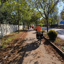
A cycling route starting in Saint-Genis-Laval, Auvergne-RhĂ´ne-Alpes, France.
Overview
About this route
- 5 h 22 min
- Duration
- 87.8 km
- Distance
- 349 m
- Ascent
- 437 m
- Descent
- 16.4 km/h
- Avg. speed
- 226 m
- Avg. speed
Route quality
Waytypes & surfaces along the route
Waytypes
Cycleway
43 km
(49 %)
Quiet road
23.2 km
(26 %)
Surfaces
Paved
67.7 km
(77 %)
Unpaved
1.2 km
(1 %)
Asphalt
67.5 km
(77 %)
Gravel
1 km
(1 %)
Continue with Bikemap
Use, edit, or download this cycling route
You would like to ride Avenue Maréchal Foch 88, Saint-Genis-Laval nach Chemin des Montats 122, Vion or customize it for your own trip? Here is what you can do with this Bikemap route:
Free features
- Save this route as favorite or in collections
- Copy & plan your own version of this route
- Sync your route with Garmin or Wahoo
Premium features
Free trial for 3 days, or one-time payment. More about Bikemap Premium.
- Navigate this route on iOS & Android
- Export a GPX / KML file of this route
- Create your custom printout (try it for free)
- Download this route for offline navigation
Discover more Premium features.
Get Bikemap PremiumFrom our community
Other popular routes starting in Saint-Genis-Laval
- 32. Tag Saint Genis Laval - Morestel
- Distance
- 84.6 km
- Ascent
- 532 m
- Descent
- 533 m
- Location
- Saint-Genis-Laval, Auvergne-RhĂ´ne-Alpes, France
- Avenue Maréchal Foch 88, Saint-Genis-Laval nach Chemin des Montats 122, Vion
- Distance
- 87.8 km
- Ascent
- 349 m
- Descent
- 437 m
- Location
- Saint-Genis-Laval, Auvergne-RhĂ´ne-Alpes, France
- SGL
- Distance
- 4.3 km
- Ascent
- 42 m
- Descent
- 49 m
- Location
- Saint-Genis-Laval, Auvergne-RhĂ´ne-Alpes, France
- retour
- Distance
- 10.1 km
- Ascent
- 136 m
- Descent
- 169 m
- Location
- Saint-Genis-Laval, Auvergne-RhĂ´ne-Alpes, France
- 90 Avenue Maréchal Foch, Saint-Genis-Laval nach 142 Allée de la Ronceraie, Laveyron
- Distance
- 82.6 km
- Ascent
- 374 m
- Descent
- 453 m
- Location
- Saint-Genis-Laval, Auvergne-RhĂ´ne-Alpes, France
- Saint-Genis-Saint Vérand
- Distance
- 42.1 km
- Ascent
- 715 m
- Descent
- 558 m
- Location
- Saint-Genis-Laval, Auvergne-RhĂ´ne-Alpes, France
- 15) St GenisLaval - Condrieu
- Distance
- 42.1 km
- Ascent
- 156 m
- Descent
- 224 m
- Location
- Saint-Genis-Laval, Auvergne-RhĂ´ne-Alpes, France
- Lyon Gre par le Vercors
- Distance
- 192 km
- Ascent
- 2,299 m
- Descent
- 2,312 m
- Location
- Saint-Genis-Laval, Auvergne-RhĂ´ne-Alpes, France
Open it in the app