
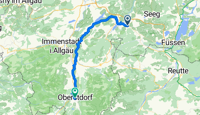
D-N-S_21b: Nesselwang - Oberstdorf
A cycling route starting in Nesselwang, Bavaria, Germany.
Overview
About this route
- -:--
- Duration
- 45.2 km
- Distance
- 489 m
- Ascent
- 549 m
- Descent
- ---
- Avg. speed
- 992 m
- Max. altitude
Route quality
Waytypes & surfaces along the route
Waytypes
Quiet road
15.7 km
(35 %)
Path
12.6 km
(28 %)
Surfaces
Paved
35.5 km
(78 %)
Unpaved
9.2 km
(20 %)
Asphalt
35.3 km
(78 %)
Gravel
8.1 km
(18 %)
Continue with Bikemap
Use, edit, or download this cycling route
You would like to ride D-N-S_21b: Nesselwang - Oberstdorf or customize it for your own trip? Here is what you can do with this Bikemap route:
Free features
- Save this route as favorite or in collections
- Copy & plan your own version of this route
- Sync your route with Garmin or Wahoo
Premium features
Free trial for 3 days, or one-time payment. More about Bikemap Premium.
- Navigate this route on iOS & Android
- Export a GPX / KML file of this route
- Create your custom printout (try it for free)
- Download this route for offline navigation
Discover more Premium features.
Get Bikemap PremiumFrom our community
Other popular routes starting in Nesselwang
 2 Drei-Täler-Radtour Allgäu-Tirol
- Distance
- 66.8 km
- Ascent
- 590 m
- Descent
- 590 m
- Location
- Nesselwang, Bavaria, Germany
 Nesselwang - Faistenoy - Oberelleg - Petersthal und zurück
- Distance
- 32 km
- Ascent
- 1,442 m
- Descent
- 1,488 m
- Location
- Nesselwang, Bavaria, Germany
 Die schöne Allgäuerin
- Distance
- 90.6 km
- Ascent
- 983 m
- Descent
- 983 m
- Location
- Nesselwang, Bavaria, Germany
 Nesselwang - Schlossberg-Alm - Schwaltenweiher - Attlesee
- Distance
- 27.1 km
- Ascent
- 384 m
- Descent
- 390 m
- Location
- Nesselwang, Bavaria, Germany
 Stubentalalm
- Distance
- 22.6 km
- Ascent
- 519 m
- Descent
- 519 m
- Location
- Nesselwang, Bavaria, Germany
 Allgäu- Tannheimer Tal
- Distance
- 79.6 km
- Ascent
- 846 m
- Descent
- 851 m
- Location
- Nesselwang, Bavaria, Germany
 Nesselwang-Wieskirche
- Distance
- 48.7 km
- Ascent
- 548 m
- Descent
- 596 m
- Location
- Nesselwang, Bavaria, Germany
 Allgäus Trails
- Distance
- 25.2 km
- Ascent
- 1,128 m
- Descent
- 1,116 m
- Location
- Nesselwang, Bavaria, Germany
Open it in the app