
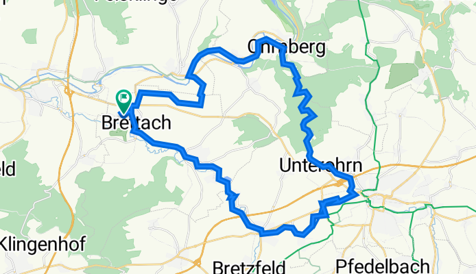
Kernerstraße 4, Langenbrettach nach Kernerstraße 1/1, Langenbrettach
A cycling route starting in Neuenstadt am Kocher, Baden-Württemberg, Germany.
Overview
About this route
- 4 h 28 min
- Duration
- 32.3 km
- Distance
- 271 m
- Ascent
- 270 m
- Descent
- 7.2 km/h
- Avg. speed
- 267 m
- Avg. speed

Route quality
Waytypes & surfaces along the route
Waytypes
Path
11.7 km
(36 %)
Track
9.5 km
(29 %)
Surfaces
Paved
30.3 km
(94 %)
Unpaved
0.1 km
(<1 %)
Asphalt
29.1 km
(90 %)
Paved (undefined)
0.7 km
(2 %)
Continue with Bikemap
Use, edit, or download this cycling route
You would like to ride Kernerstraße 4, Langenbrettach nach Kernerstraße 1/1, Langenbrettach or customize it for your own trip? Here is what you can do with this Bikemap route:
Free features
- Save this route as favorite or in collections
- Copy & plan your own version of this route
- Sync your route with Garmin or Wahoo
Premium features
Free trial for 3 days, or one-time payment. More about Bikemap Premium.
- Navigate this route on iOS & Android
- Export a GPX / KML file of this route
- Create your custom printout (try it for free)
- Download this route for offline navigation
Discover more Premium features.
Get Bikemap PremiumFrom our community
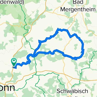
Other popular routes starting in Neuenstadt am Kocher
 Kocher Jagst östl Route
- Distance
- 61.4 km
- Ascent
- 569 m
- Descent
- 569 m
- Location
- Neuenstadt am Kocher, Baden-Württemberg, Germany
 Rundwanderung Brettacher Wald
- Distance
- 9.6 km
- Ascent
- 244 m
- Descent
- 246 m
- Location
- Neuenstadt am Kocher, Baden-Württemberg, Germany
 Zur Almhütte bei Pfedelbach
- Distance
- 44.7 km
- Ascent
- 429 m
- Descent
- 434 m
- Location
- Neuenstadt am Kocher, Baden-Württemberg, Germany
 Training circle
- Distance
- 11.5 km
- Ascent
- 224 m
- Descent
- 222 m
- Location
- Neuenstadt am Kocher, Baden-Württemberg, Germany
 Route zwischen Kocher und Jagst
- Distance
- 91 km
- Ascent
- 591 m
- Descent
- 589 m
- Location
- Neuenstadt am Kocher, Baden-Württemberg, Germany
 Runde Höchstberg/Mosbach u. am Neckar zurück
- Distance
- 54.8 km
- Ascent
- 645 m
- Descent
- 645 m
- Location
- Neuenstadt am Kocher, Baden-Württemberg, Germany
 Kocher-Jagst-Tour
- Distance
- 111.1 km
- Ascent
- 612 m
- Descent
- 612 m
- Location
- Neuenstadt am Kocher, Baden-Württemberg, Germany
 von Stein zum Ochsengarten
- Distance
- 30.3 km
- Ascent
- 200 m
- Descent
- 206 m
- Location
- Neuenstadt am Kocher, Baden-Württemberg, Germany
Open it in the app