
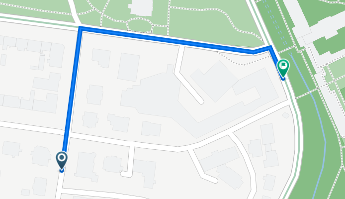
Richard-Wagner-Straße 6, Bad Elster nach Badstraße 21, Bad Elster
A cycling route starting in Bad Elster, Saxony, Germany.
Overview
About this route
- 1 min
- Duration
- 0.4 km
- Distance
- 0 m
- Ascent
- 17 m
- Descent
- 17.3 km/h
- Avg. speed
- 498 m
- Avg. speed

Route quality
Waytypes & surfaces along the route
Waytypes
Road
0.3 km
(86 %)
Quiet road
0 km
(10 %)
Pedestrian area
0 km
(5 %)
Surfaces
Paved
0.3 km
(95 %)
Asphalt
0.3 km
(95 %)
Undefined
0 km
(5 %)
Continue with Bikemap
Use, edit, or download this cycling route
You would like to ride Richard-Wagner-Straße 6, Bad Elster nach Badstraße 21, Bad Elster or customize it for your own trip? Here is what you can do with this Bikemap route:
Free features
- Save this route as favorite or in collections
- Copy & plan your own version of this route
- Sync your route with Garmin or Wahoo
Premium features
Free trial for 3 days, or one-time payment. More about Bikemap Premium.
- Navigate this route on iOS & Android
- Export a GPX / KML file of this route
- Create your custom printout (try it for free)
- Download this route for offline navigation
Discover more Premium features.
Get Bikemap PremiumFrom our community
Other popular routes starting in Bad Elster
 2023_07 Studánka - Trojmezí pěšky
- Distance
- 9.4 km
- Ascent
- 95 m
- Descent
- 157 m
- Location
- Bad Elster, Saxony, Germany
 Bad Elster - Sohl - Remtengrün - Mühlhausen - Bad Elster
- Distance
- 19 km
- Ascent
- 423 m
- Descent
- 422 m
- Location
- Bad Elster, Saxony, Germany
 BE - Vernérov - BE
- Distance
- 24.7 km
- Ascent
- 300 m
- Descent
- 300 m
- Location
- Bad Elster, Saxony, Germany
 Heimweg Elsterradweg
- Distance
- 3.3 km
- Ascent
- 63 m
- Descent
- 59 m
- Location
- Bad Elster, Saxony, Germany
 Ringweg komplett Uhrzeigersinn
- Distance
- 22.4 km
- Ascent
- 679 m
- Descent
- 682 m
- Location
- Bad Elster, Saxony, Germany
 Bad Elster - Tschechei - Bad Elster CLONED FROM ROUTE 876186
- Distance
- 25.2 km
- Ascent
- 313 m
- Descent
- 313 m
- Location
- Bad Elster, Saxony, Germany
 Trailtour an der Grenze
- Distance
- 34.7 km
- Ascent
- 547 m
- Descent
- 549 m
- Location
- Bad Elster, Saxony, Germany
 Elster - Hainberg
- Distance
- 10.4 km
- Ascent
- 405 m
- Descent
- 139 m
- Location
- Bad Elster, Saxony, Germany
Open it in the app