

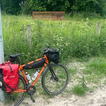
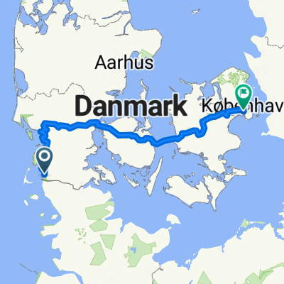
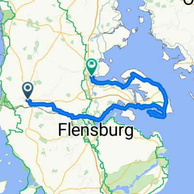
Danemark
A cycling route starting in Tønder, Region South Denmark, Denmark.
Overview
About this route
- -:--
- Duration
- 518.7 km
- Distance
- 760 m
- Ascent
- 761 m
- Descent
- ---
- Avg. speed
- 77 m
- Max. altitude

Route quality
Waytypes & surfaces along the route
Waytypes
Road
134.9 km
(26 %)
Quiet road
114.1 km
(22 %)
Surfaces
Paved
404.6 km
(78 %)
Unpaved
98.6 km
(19 %)
Asphalt
399.4 km
(77 %)
Gravel
72.6 km
(14 %)
Route highlights
Points of interest along the route
Point of interest after 2.7 km
Nuit 1
Point of interest after 52.1 km
Nuit 2
Point of interest after 104.7 km
Nuit 3
Point of interest after 153.2 km
Nuit 4
Point of interest after 234.8 km
Nuit 5 après une énorme journée
Point of interest after 265.3 km
Nuit 6 Parc naturel à côté pour randonnée
Point of interest after 305.1 km
Nuit 7
Point of interest after 370.5 km
Nuit 8
Point of interest after 433.9 km
Nuit 9
Point of interest after 505.3 km
Nuit 10
Continue with Bikemap
Use, edit, or download this cycling route
You would like to ride Danemark or customize it for your own trip? Here is what you can do with this Bikemap route:
Free features
- Save this route as favorite or in collections
- Copy & plan your own version of this route
- Split it into stages to create a multi-day tour
- Sync your route with Garmin or Wahoo
Premium features
Free trial for 3 days, or one-time payment. More about Bikemap Premium.
- Navigate this route on iOS & Android
- Export a GPX / KML file of this route
- Create your custom printout (try it for free)
- Download this route for offline navigation
Discover more Premium features.
Get Bikemap PremiumFrom our community
Other popular routes starting in Tønder
 Koldin Niebul
- Distance
- 85.6 km
- Ascent
- 19 m
- Descent
- 18 m
- Location
- Tønder, Region South Denmark, Denmark
 Lægan to Vadehavscentret
- Distance
- 56.9 km
- Ascent
- 61 m
- Descent
- 65 m
- Location
- Tønder, Region South Denmark, Denmark
 Traversée danemark
- Distance
- 414.9 km
- Ascent
- 300 m
- Descent
- 299 m
- Location
- Tønder, Region South Denmark, Denmark
 2023 v1
- Distance
- 586.9 km
- Ascent
- 1,247 m
- Descent
- 1,250 m
- Location
- Tønder, Region South Denmark, Denmark
 Danemark
- Distance
- 698.2 km
- Ascent
- 488 m
- Descent
- 484 m
- Location
- Tønder, Region South Denmark, Denmark
 From Højer to Åbenrå
- Distance
- 113.7 km
- Ascent
- 397 m
- Descent
- 370 m
- Location
- Tønder, Region South Denmark, Denmark
 Vestkystruten
- Distance
- 563.5 km
- Ascent
- 1,002 m
- Descent
- 1,003 m
- Location
- Tønder, Region South Denmark, Denmark
 Tønder to Åbenrå
- Distance
- 180.5 km
- Ascent
- 855 m
- Descent
- 848 m
- Location
- Tønder, Region South Denmark, Denmark
Open it in the app