Słupsk - cmentarz w Machowinie
A cycling route starting in Kobylnica, Pomeranian Voivodeship, Poland.
Overview
About this route
Cmentarz w Machowinie jest jedynym w gminie Ustka, na którym spoczywają wyznawcy różnych religii.
- -:--
- Duration
- 18.3 km
- Distance
- 84 m
- Ascent
- 80 m
- Descent
- ---
- Avg. speed
- ---
- Max. altitude
Route highlights
Points of interest along the route

Photo after 9.6 km

Photo after 9.9 km
Dolina Słupi

Photo after 10.1 km

Photo after 10.5 km

Photo after 11.4 km

Photo after 11.6 km
Cmentarz w Machowinie

Photo after 12.8 km
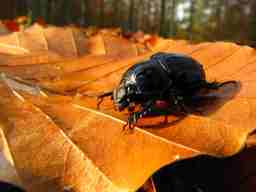
Chyba niejadalny?!

Photo after 13.6 km
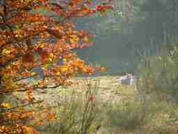
Na polowaniu

Photo after 14.5 km
Uroki jesieni
Continue with Bikemap
Use, edit, or download this cycling route
You would like to ride Słupsk - cmentarz w Machowinie or customize it for your own trip? Here is what you can do with this Bikemap route:
Free features
- Save this route as favorite or in collections
- Copy & plan your own version of this route
- Sync your route with Garmin or Wahoo
Premium features
Free trial for 3 days, or one-time payment. More about Bikemap Premium.
- Navigate this route on iOS & Android
- Export a GPX / KML file of this route
- Create your custom printout (try it for free)
- Download this route for offline navigation
Discover more Premium features.
Get Bikemap PremiumFrom our community
Other popular routes starting in Kobylnica
 Pierścień Gryfitów cz. płd.-zach.
- Distance
- 60.5 km
- Ascent
- 161 m
- Descent
- 160 m
- Location
- Kobylnica, Pomeranian Voivodeship, Poland
 Rowerem ze Szprychą po Gminie Kobylnica – Powitanie lata - 22.06.2019 r.
- Distance
- 22.4 km
- Ascent
- 123 m
- Descent
- 122 m
- Location
- Kobylnica, Pomeranian Voivodeship, Poland
 Słupsk_Wrząca_Suchorze_Dobieszewo__102 km
- Distance
- 95.1 km
- Ascent
- 312 m
- Descent
- 341 m
- Location
- Kobylnica, Pomeranian Voivodeship, Poland
 Mogiły Puttkamera i Zitzewitza w Łosinie
- Distance
- 7.6 km
- Ascent
- 14 m
- Descent
- 20 m
- Location
- Kobylnica, Pomeranian Voivodeship, Poland
 Słupsk - cmentarz w Machowinie
- Distance
- 18.3 km
- Ascent
- 84 m
- Descent
- 80 m
- Location
- Kobylnica, Pomeranian Voivodeship, Poland
 Jagodowa 6, Krępa Słupska do Jagodowa 4, Krępa Słupska
- Distance
- 64.5 km
- Ascent
- 609 m
- Descent
- 607 m
- Location
- Kobylnica, Pomeranian Voivodeship, Poland
 Trasa Wąski i Czujny 14-15 października 2011.
- Distance
- 84.9 km
- Ascent
- 249 m
- Descent
- 238 m
- Location
- Kobylnica, Pomeranian Voivodeship, Poland
 Żoruchowo
- Distance
- 52.5 km
- Ascent
- 174 m
- Descent
- 177 m
- Location
- Kobylnica, Pomeranian Voivodeship, Poland
Open it in the app


