

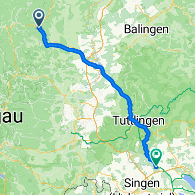
Schiltach - Donaueschingen - Geisingen
A cycling route starting in Schiltach, Baden-Wurttemberg, Germany.
Overview
About this route
- -:--
- Duration
- 74.3 km
- Distance
- 936 m
- Ascent
- 597 m
- Descent
- ---
- Avg. speed
- 901 m
- Max. altitude

Route quality
Waytypes & surfaces along the route
Waytypes
Track
24.5 km
(33 %)
Road
10.4 km
(14 %)
Surfaces
Paved
60.9 km
(82 %)
Unpaved
2.2 km
(3 %)
Asphalt
60.2 km
(81 %)
Gravel
1.5 km
(2 %)
Continue with Bikemap
Use, edit, or download this cycling route
You would like to ride Schiltach - Donaueschingen - Geisingen or customize it for your own trip? Here is what you can do with this Bikemap route:
Free features
- Save this route as favorite or in collections
- Copy & plan your own version of this route
- Sync your route with Garmin or Wahoo
Premium features
Free trial for 3 days, or one-time payment. More about Bikemap Premium.
- Navigate this route on iOS & Android
- Export a GPX / KML file of this route
- Create your custom printout (try it for free)
- Download this route for offline navigation
Discover more Premium features.
Get Bikemap PremiumFrom our community
Other popular routes starting in Schiltach
 Schiltach - Schömberg - Ödenwald - Masselkopf - Loßburg
- Distance
- 31.2 km
- Ascent
- 904 m
- Descent
- 582 m
- Location
- Schiltach, Baden-Wurttemberg, Germany
 Schiltach - Eigeltingen
- Distance
- 83.6 km
- Ascent
- 1,544 m
- Descent
- 1,492 m
- Location
- Schiltach, Baden-Wurttemberg, Germany
 Schiltach, Holzebene, Fräulinsberg, Kegelriß, Röthenbach, Schiltach
- Distance
- 21 km
- Ascent
- 578 m
- Descent
- 583 m
- Location
- Schiltach, Baden-Wurttemberg, Germany
 Schiltach, Mattenweiher, Teisenkopf, Heubach, Schiltach
- Distance
- 19.1 km
- Ascent
- 520 m
- Descent
- 511 m
- Location
- Schiltach, Baden-Wurttemberg, Germany
 Schiltach, Burgruine Hohenschramberg, Kienbronn, Schiltach
- Distance
- 32.2 km
- Ascent
- 763 m
- Descent
- 810 m
- Location
- Schiltach, Baden-Wurttemberg, Germany
 Kinzigtal und Schwarzwaldhöhen
- Distance
- 20.9 km
- Ascent
- 519 m
- Descent
- 513 m
- Location
- Schiltach, Baden-Wurttemberg, Germany
 Schiltach - Mattenweiher - Salzlecke - Wittichen - Schiltach
- Distance
- 26.3 km
- Ascent
- 744 m
- Descent
- 796 m
- Location
- Schiltach, Baden-Wurttemberg, Germany
 Schiltach, Mooswaldkopf, Windkapf - Teil 1/2
- Distance
- 20.9 km
- Ascent
- 811 m
- Descent
- 247 m
- Location
- Schiltach, Baden-Wurttemberg, Germany
Open it in the app