
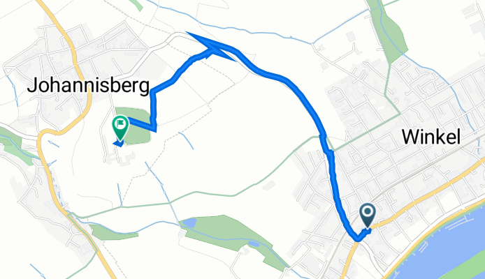
Hauptstraße 122, Oestrich-Winkel nach Geisenheim
A cycling route starting in Oestrich-Winkel, Rhineland-Palatinate, Germany.
Overview
About this route
- 14 min
- Duration
- 2.7 km
- Distance
- 125 m
- Ascent
- 29 m
- Descent
- 11.1 km/h
- Avg. speed
- 187 m
- Avg. speed
Continue with Bikemap
Use, edit, or download this cycling route
You would like to ride Hauptstraße 122, Oestrich-Winkel nach Geisenheim or customize it for your own trip? Here is what you can do with this Bikemap route:
Free features
- Save this route as favorite or in collections
- Copy & plan your own version of this route
- Sync your route with Garmin or Wahoo
Premium features
Free trial for 3 days, or one-time payment. More about Bikemap Premium.
- Navigate this route on iOS & Android
- Export a GPX / KML file of this route
- Create your custom printout (try it for free)
- Download this route for offline navigation
Discover more Premium features.
Get Bikemap PremiumFrom our community
Other popular routes starting in Oestrich-Winkel
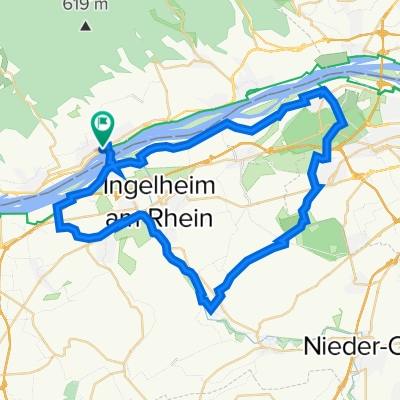
 Route in Geisenheim
- Distance
- 34.4 km
- Ascent
- 502 m
- Descent
- 502 m
- Location
- Oestrich-Winkel, Rhineland-Palatinate, Germany
 Mittelheim_Lenneberg_Schwabenheim
- Distance
- 48.8 km
- Ascent
- 184 m
- Descent
- 187 m
- Location
- Oestrich-Winkel, Rhineland-Palatinate, Germany
 Sonntagsrunde mit Kathrin
- Distance
- 20.3 km
- Ascent
- 300 m
- Descent
- 300 m
- Location
- Oestrich-Winkel, Rhineland-Palatinate, Germany
 Rheingau retour
- Distance
- 17.9 km
- Ascent
- 55 m
- Descent
- 72 m
- Location
- Oestrich-Winkel, Rhineland-Palatinate, Germany
 Rheingau 1
- Distance
- 33 km
- Ascent
- 182 m
- Descent
- 182 m
- Location
- Oestrich-Winkel, Rhineland-Palatinate, Germany
 Ingelheim am Rhein nach Ingelheimer Straße, Schwabenheim an der Selz
- Distance
- 21 km
- Ascent
- 169 m
- Descent
- 120 m
- Location
- Oestrich-Winkel, Rhineland-Palatinate, Germany
 Vordertaunus-Wispertal
- Distance
- 57.3 km
- Ascent
- 735 m
- Descent
- 735 m
- Location
- Oestrich-Winkel, Rhineland-Palatinate, Germany
 Route in Geisenheim
- Distance
- 34.4 km
- Ascent
- 502 m
- Descent
- 502 m
- Location
- Oestrich-Winkel, Rhineland-Palatinate, Germany
Open it in the app