

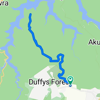
Terrey Hills (2)
A cycling route starting in Ingleside, New South Wales, Australia.
Overview
About this route
- -:--
- Duration
- 22.6 km
- Distance
- 236 m
- Ascent
- 238 m
- Descent
- ---
- Avg. speed
- ---
- Max. altitude
Continue with Bikemap
Use, edit, or download this cycling route
You would like to ride Terrey Hills (2) or customize it for your own trip? Here is what you can do with this Bikemap route:
Free features
- Save this route as favorite or in collections
- Copy & plan your own version of this route
- Sync your route with Garmin or Wahoo
Premium features
Free trial for 3 days, or one-time payment. More about Bikemap Premium.
- Navigate this route on iOS & Android
- Export a GPX / KML file of this route
- Create your custom printout (try it for free)
- Download this route for offline navigation
Discover more Premium features.
Get Bikemap PremiumFrom our community
Other popular routes starting in Ingleside
 Terrey Hills (2)
- Distance
- 22.6 km
- Ascent
- 236 m
- Descent
- 238 m
- Location
- Ingleside, New South Wales, Australia
 Terrey Hills ReAccred
- Distance
- 23 km
- Ascent
- 244 m
- Descent
- 244 m
- Location
- Ingleside, New South Wales, Australia
 Terrey Hills ReAccred 2020
- Distance
- 17.5 km
- Ascent
- 296 m
- Descent
- 294 m
- Location
- Ingleside, New South Wales, Australia
 Terry Hills Com - Akuna Descent - West Heads - WestH Climb
- Distance
- 45.2 km
- Ascent
- 558 m
- Descent
- 558 m
- Location
- Ingleside, New South Wales, Australia
 West Head ride
- Distance
- 26.9 km
- Ascent
- 565 m
- Descent
- 585 m
- Location
- Ingleside, New South Wales, Australia
 102A Booralie Road, Terrey Hills to 102A Booralie Road, Terrey Hills
- Distance
- 18.1 km
- Ascent
- 304 m
- Descent
- 302 m
- Location
- Ingleside, New South Wales, Australia
 AkunaBay-WestHead
- Distance
- 67.1 km
- Ascent
- 697 m
- Descent
- 704 m
- Location
- Ingleside, New South Wales, Australia
 Akuna - West Head (50km)
- Distance
- 50.5 km
- Ascent
- 840 m
- Descent
- 851 m
- Location
- Ingleside, New South Wales, Australia
Open it in the app