

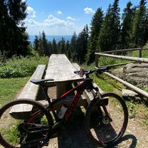
Rožňava - Brzotín - Slavec - Gombasek / jaskyňa
A cycling route starting in Rožňava, Košice Region, Slovakia.
Overview
About this route
Asfalt - cesty, polne / lesne cesty
- -:--
- Duration
- 13.3 km
- Distance
- 38 m
- Ascent
- 85 m
- Descent
- ---
- Avg. speed
- 300 m
- Max. altitude

Route quality
Waytypes & surfaces along the route
Waytypes
Track
5.1 km
(38 %)
Road
4 km
(30 %)
Surfaces
Paved
6.1 km
(46 %)
Unpaved
2.9 km
(22 %)
Asphalt
4.1 km
(31 %)
Gravel
2.5 km
(19 %)
Continue with Bikemap
Use, edit, or download this cycling route
You would like to ride Rožňava - Brzotín - Slavec - Gombasek / jaskyňa or customize it for your own trip? Here is what you can do with this Bikemap route:
Free features
- Save this route as favorite or in collections
- Copy & plan your own version of this route
- Sync your route with Garmin or Wahoo
Premium features
Free trial for 3 days, or one-time payment. More about Bikemap Premium.
- Navigate this route on iOS & Android
- Export a GPX / KML file of this route
- Create your custom printout (try it for free)
- Download this route for offline navigation
Discover more Premium features.
Get Bikemap PremiumFrom our community
Other popular routes starting in Rožňava
 Sunday Track In Lúčka
- Distance
- 18.8 km
- Ascent
- 815 m
- Descent
- 823 m
- Location
- Rožňava, Košice Region, Slovakia
 Stit
Stit- Distance
- 39.3 km
- Ascent
- 680 m
- Descent
- 683 m
- Location
- Rožňava, Košice Region, Slovakia
 Rožňava- Brzotín- Slavec- Gombasek / jaskyňa
- Distance
- 13.2 km
- Ascent
- 66 m
- Descent
- 84 m
- Location
- Rožňava, Košice Region, Slovakia
 Úhornianske sedlo- Kaplnka- Jezero
- Distance
- 8 km
- Ascent
- 142 m
- Descent
- 502 m
- Location
- Rožňava, Košice Region, Slovakia
 Smolník MTB 50km, Smolník
- Distance
- 58.6 km
- Ascent
- 3,935 m
- Descent
- 3,923 m
- Location
- Rožňava, Košice Region, Slovakia
 Test
Test- Distance
- 24.7 km
- Ascent
- 446 m
- Descent
- 446 m
- Location
- Rožňava, Košice Region, Slovakia
 chata Volovec
- Distance
- 13.8 km
- Ascent
- 1,126 m
- Descent
- 365 m
- Location
- Rožňava, Košice Region, Slovakia
 Za Čučmou
- Distance
- 13.2 km
- Ascent
- 602 m
- Descent
- 607 m
- Location
- Rožňava, Košice Region, Slovakia
Open it in the app