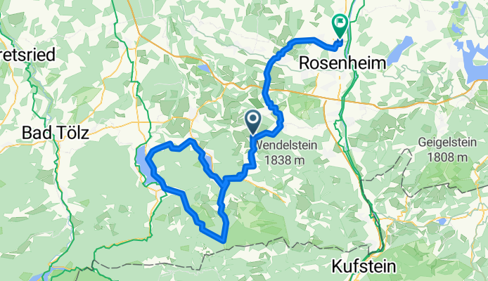
3-Seen-Runde
A cycling route starting in Fischbachau, Bavaria, Germany.
Overview
About this route
Sylvensteinpass ( 3,6km ) mit bis zu 11% Steigung.
Weiter kurze knackige Anstiege von St.Quirin nach Oberbuchberg und von Unterschuss nach Oberschuss.
Landschaftlich reizvollste Strecke von Spitzingsee über Valepp runter nach Enterrottach.
- -:--
- Duration
- 101.3 km
- Distance
- 829 m
- Ascent
- 1,187 m
- Descent
- ---
- Avg. speed
- ---
- Max. altitude
Route highlights
Points of interest along the route
Point of interest after 30.5 km
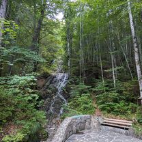
Abzweig-Rottach-Dammweg!
Continue with Bikemap
Use, edit, or download this cycling route
You would like to ride 3-Seen-Runde or customize it for your own trip? Here is what you can do with this Bikemap route:
Free features
- Save this route as favorite or in collections
- Copy & plan your own version of this route
- Split it into stages to create a multi-day tour
- Sync your route with Garmin or Wahoo
Premium features
Free trial for 3 days, or one-time payment. More about Bikemap Premium.
- Navigate this route on iOS & Android
- Export a GPX / KML file of this route
- Create your custom printout (try it for free)
- Download this route for offline navigation
Discover more Premium features.
Get Bikemap PremiumFrom our community
Other popular routes starting in Fischbachau
- 08-Jaegerkamp-Schneeschuh
- Distance
- 11.6 km
- Ascent
- 694 m
- Descent
- 697 m
- Location
- Fischbachau, Bavaria, Germany
- Von Neuhaus über den Soinsee zum Rotwandhaus
- Distance
- 29.4 km
- Ascent
- 1,059 m
- Descent
- 1,059 m
- Location
- Fischbachau, Bavaria, Germany
- Tegernsee Tour über Bad Feilnbach und Spitzingsee
- Distance
- 87.7 km
- Ascent
- 1,061 m
- Descent
- 1,062 m
- Location
- Fischbachau, Bavaria, Germany
- Neuhaus zum Soinsee, Großtiefenthalalm
- Distance
- 27.5 km
- Ascent
- 908 m
- Descent
- 906 m
- Location
- Fischbachau, Bavaria, Germany
- Schliersee-Tegernsee
- Distance
- 52.8 km
- Ascent
- 961 m
- Descent
- 1,212 m
- Location
- Fischbachau, Bavaria, Germany
- Leitzachtaler Bergblickweg
- Distance
- 12.2 km
- Ascent
- 198 m
- Descent
- 176 m
- Location
- Fischbachau, Bavaria, Germany
- Spitzingsee nach Enterrottach über die Almen
- Distance
- 28.4 km
- Ascent
- 765 m
- Descent
- 764 m
- Location
- Fischbachau, Bavaria, Germany
- vom Spitzingsee - ums ht. Sonnwendjoch - über den Elendsattel
- Distance
- 43.9 km
- Ascent
- 1,387 m
- Descent
- 1,488 m
- Location
- Fischbachau, Bavaria, Germany
Open it in the app