
Tegel 10, 48 Km - eine Fahrt im Schatten
A cycling route starting in Tegel, State of Berlin, Germany.
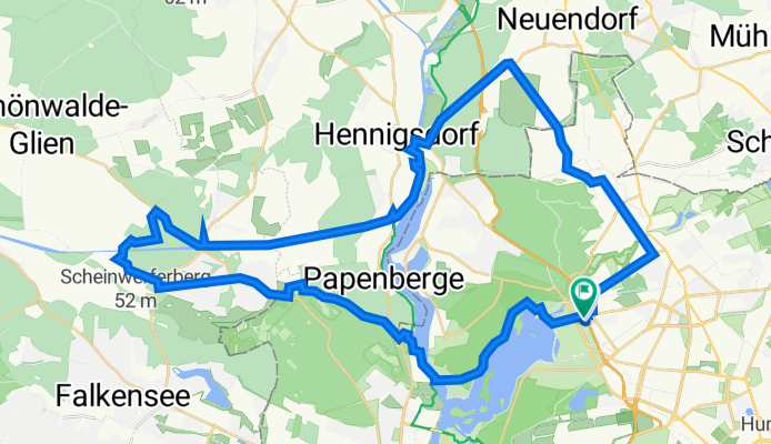
Overview
About this route
It was very hot that day. The intention was to ride as much as possible in the shade, without much planning.
- 3 h 27 min
- Duration
- 47.6 km
- Distance
- 227 m
- Ascent
- 224 m
- Descent
- 13.8 km/h
- Avg. speed
- 61 m
- Max. altitude

Route photos


Route quality
Waytypes & surfaces along the route
Waytypes
Path
12.4 km
(26 %)
Track
10 km
(21 %)
Surfaces
Paved
35.7 km
(75 %)
Unpaved
6.2 km
(13 %)
Asphalt
32.8 km
(69 %)
Gravel
4.8 km
(10 %)
Continue with Bikemap
Use, edit, or download this cycling route
You would like to ride Tegel 10, 48 Km - eine Fahrt im Schatten or customize it for your own trip? Here is what you can do with this Bikemap route:
Free features
- Save this route as favorite or in collections
- Copy & plan your own version of this route
- Sync your route with Garmin or Wahoo
Premium features
Free trial for 3 days, or one-time payment. More about Bikemap Premium.
- Navigate this route on iOS & Android
- Export a GPX / KML file of this route
- Create your custom printout (try it for free)
- Download this route for offline navigation
Discover more Premium features.
Get Bikemap PremiumFrom our community
Other popular routes starting in Tegel
 Tegel 5, Rad und Geschichte
- Distance
- 22.2 km
- Ascent
- 84 m
- Descent
- 84 m
- Location
- Tegel, State of Berlin, Germany
 Freienhagen
- Distance
- 89.2 km
- Ascent
- 128 m
- Descent
- 128 m
- Location
- Tegel, State of Berlin, Germany
 Kurze Radrunde durch Berlin
- Distance
- 2.1 km
- Ascent
- 24 m
- Descent
- 19 m
- Location
- Tegel, State of Berlin, Germany
 Berlin - Mecklenburger Seenplatte
- Distance
- 211.7 km
- Ascent
- 651 m
- Descent
- 649 m
- Location
- Tegel, State of Berlin, Germany
 NordTour_Rundfahrt
- Distance
- 36.4 km
- Ascent
- 103 m
- Descent
- 97 m
- Location
- Tegel, State of Berlin, Germany
 Tegel 10, 48 Km - eine Fahrt im Schatten
- Distance
- 47.6 km
- Ascent
- 227 m
- Descent
- 224 m
- Location
- Tegel, State of Berlin, Germany
 Tegel 6, viel Wald und ein Stück Mauerweg
- Distance
- 31.1 km
- Ascent
- 169 m
- Descent
- 166 m
- Location
- Tegel, State of Berlin, Germany
 Von Tegel nach Spandau
- Distance
- 12.4 km
- Ascent
- 14 m
- Descent
- 20 m
- Location
- Tegel, State of Berlin, Germany
Open it in the app