

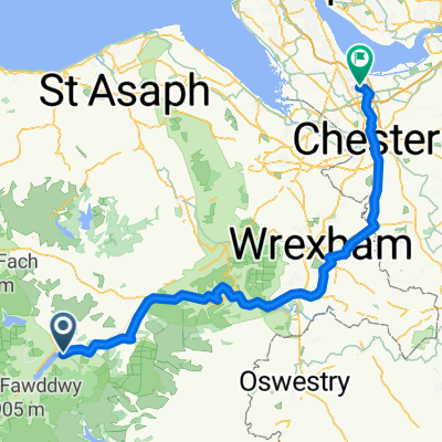
Glanllyn Lodge, Bala to Llanycil Community, Bala
A cycling route starting in Bala, Wales, United Kingdom.
Overview
About this route
- 34 min
- Duration
- 8 km
- Distance
- 178 m
- Ascent
- 128 m
- Descent
- 14.1 km/h
- Avg. speed
- 281 m
- Max. altitude

Route quality
Waytypes & surfaces along the route
Waytypes
Quiet road
5.8 km
(72 %)
Pedestrian area
2.2 km
(27 %)
Cycleway
0 km
(<1 %)
Surfaces
Paved
2.9 km
(36 %)
Paved (undefined)
2.2 km
(27 %)
Asphalt
0.7 km
(8 %)
Undefined
5.2 km
(64 %)
Continue with Bikemap
Use, edit, or download this cycling route
You would like to ride Glanllyn Lodge, Bala to Llanycil Community, Bala or customize it for your own trip? Here is what you can do with this Bikemap route:
Free features
- Save this route as favorite or in collections
- Copy & plan your own version of this route
- Sync your route with Garmin or Wahoo
Premium features
Free trial for 3 days, or one-time payment. More about Bikemap Premium.
- Navigate this route on iOS & Android
- Export a GPX / KML file of this route
- Create your custom printout (try it for free)
- Download this route for offline navigation
Discover more Premium features.
Get Bikemap PremiumFrom our community
Other popular routes starting in Bala
 40Km Lake V
- Distance
- 37.8 km
- Ascent
- 358 m
- Descent
- 360 m
- Location
- Bala, Wales, United Kingdom
 Gran Fondo Cymru, 24 May 2009
- Distance
- 190.9 km
- Ascent
- 1,780 m
- Descent
- 1,781 m
- Location
- Bala, Wales, United Kingdom
 Bala Cycling
- Distance
- 3.3 km
- Ascent
- 102 m
- Descent
- 16 m
- Location
- Bala, Wales, United Kingdom
 Beicio I Gymru Pt2
- Distance
- 97.8 km
- Ascent
- 1,286 m
- Descent
- 1,417 m
- Location
- Bala, Wales, United Kingdom
 Bala home flat route
- Distance
- 94.8 km
- Ascent
- 242 m
- Descent
- 405 m
- Location
- Bala, Wales, United Kingdom
 Bala lake circular
- Distance
- 23.4 km
- Ascent
- 214 m
- Descent
- 220 m
- Location
- Bala, Wales, United Kingdom
 Glanllyn Lodge, Bala to Llanycil Community, Bala
- Distance
- 8 km
- Ascent
- 178 m
- Descent
- 128 m
- Location
- Bala, Wales, United Kingdom
 tegid
tegid- Distance
- 14.3 km
- Ascent
- 261 m
- Descent
- 216 m
- Location
- Bala, Wales, United Kingdom
Open it in the app