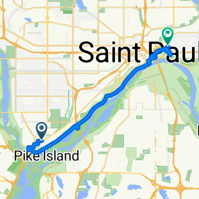
Sibley Memorial Highway 1332, Mendota to West 26th Street 819, Minneapolis
A cycling route starting in Mendota Heights, Minnesota, United States of America.
Overview
About this route
- 50 min
- Duration
- 17.3 km
- Distance
- 75 m
- Ascent
- 13 m
- Descent
- 20.7 km/h
- Avg. speed
- 267 m
- Avg. speed
Route quality
Waytypes & surfaces along the route
Waytypes
Undefined
17.3 km
(100 %)
Surfaces
Undefined
17.3 km
(100 %)
Continue with Bikemap
Use, edit, or download this cycling route
You would like to ride Sibley Memorial Highway 1332, Mendota to West 26th Street 819, Minneapolis or customize it for your own trip? Here is what you can do with this Bikemap route:
Free features
- Save this route as favorite or in collections
- Copy & plan your own version of this route
- Sync your route with Garmin or Wahoo
Premium features
Free trial for 3 days, or one-time payment. More about Bikemap Premium.
- Navigate this route on iOS & Android
- Export a GPX / KML file of this route
- Create your custom printout (try it for free)
- Download this route for offline navigation
Discover more Premium features.
Get Bikemap PremiumFrom our community
Other popular routes starting in Mendota Heights
- South Minnehaha Drive 4935-4925, Minneapolis to South Minnehaha Drive, Minneapolis
- Distance
- 39.9 km
- Ascent
- 10 m
- Descent
- 3 m
- Location
- Mendota Heights, Minnesota, United States of America
- Mendota to Calhoun
- Distance
- 22 km
- Ascent
- 171 m
- Descent
- 132 m
- Location
- Mendota Heights, Minnesota, United States of America
- Mendota Heights-South St.Paul
- Distance
- 35.7 km
- Ascent
- 218 m
- Descent
- 218 m
- Location
- Mendota Heights, Minnesota, United States of America
- B2B00191 55115>55401viaRandolph/MissBlvd/LkStBridge/WRiverPkwy/WashAv
- Distance
- 11.6 km
- Ascent
- 97 m
- Descent
- 109 m
- Location
- Mendota Heights, Minnesota, United States of America
- Snail-like route in Mendota Heights
- Distance
- 14 km
- Ascent
- 325 m
- Descent
- 325 m
- Location
- Mendota Heights, Minnesota, United States of America
- B2B00914 55116>55435 via Mend Brg, 494 bike brg, 73rd
- Distance
- 22.6 km
- Ascent
- 141 m
- Descent
- 132 m
- Location
- Mendota Heights, Minnesota, United States of America
- Big Rivers, Pilot Knob, Acadia, Valley Park, ...
- Distance
- 13.3 km
- Ascent
- 206 m
- Descent
- 206 m
- Location
- Mendota Heights, Minnesota, United States of America
- Fort Snelling Loop
- Distance
- 33.8 km
- Ascent
- 162 m
- Descent
- 164 m
- Location
- Mendota Heights, Minnesota, United States of America