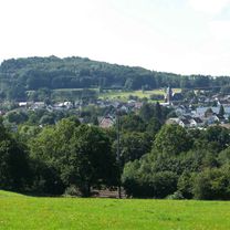
Wied, Kroppacher Schweiz, Norken, Nistertal, Dreifelder Weiher
A cycling route starting in Wied, Rhineland-Palatinate, Germany.
Overview
About this route
Attention, the tour has a flaw. The pedestrian bridge over the B 414 is an absolute design failure: bicycles must be carried up the steep stairs, even though there is no other crossing option for bicycles over the multi-lane federal road between Schneidmühle and Kirburg, which is especially unpleasant with e-bikes. Moreover, the muddy and overgrown accesses to the bridge are also a problem – a prime example of wasted public funds!
- -:--
- Duration
- 43.9 km
- Distance
- 715 m
- Ascent
- 717 m
- Descent
- ---
- Avg. speed
- 465 m
- Max. altitude
Route photos
Route quality
Waytypes & surfaces along the route
Waytypes
Road
15.4 km
(35 %)
Track
15.4 km
(35 %)
Surfaces
Paved
18.9 km
(43 %)
Unpaved
13.2 km
(30 %)
Asphalt
17.1 km
(39 %)
Gravel
5.7 km
(13 %)
Continue with Bikemap
Use, edit, or download this cycling route
You would like to ride Wied, Kroppacher Schweiz, Norken, Nistertal, Dreifelder Weiher or customize it for your own trip? Here is what you can do with this Bikemap route:
Free features
- Save this route as favorite or in collections
- Copy & plan your own version of this route
- Sync your route with Garmin or Wahoo
Premium features
Free trial for 3 days, or one-time payment. More about Bikemap Premium.
- Navigate this route on iOS & Android
- Export a GPX / KML file of this route
- Create your custom printout (try it for free)
- Download this route for offline navigation
Discover more Premium features.
Get Bikemap PremiumFrom our community
Other popular routes starting in Wied
 Wied Himburg Rotenhain Alpenrod Hattert Wied
- Distance
- 43.7 km
- Ascent
- 587 m
- Descent
- 587 m
- Location
- Wied, Rhineland-Palatinate, Germany
 Wied Ailertchen Lange Schneise Wied
- Distance
- 38.8 km
- Ascent
- 564 m
- Descent
- 567 m
- Location
- Wied, Rhineland-Palatinate, Germany
 Wied, Herschbach, Dreifelden, Hachenburg, Wied nach Talstraße 6, Wied
- Distance
- 38.4 km
- Ascent
- 490 m
- Descent
- 489 m
- Location
- Wied, Rhineland-Palatinate, Germany
 Wied - Montabaur
- Distance
- 58.2 km
- Ascent
- 847 m
- Descent
- 856 m
- Location
- Wied, Rhineland-Palatinate, Germany
 Alte Mühle Mübach., Reichenstein, Niederähren
- Distance
- 39.2 km
- Ascent
- 646 m
- Descent
- 641 m
- Location
- Wied, Rhineland-Palatinate, Germany
 Rund um Obersayn
- Distance
- 46.2 km
- Ascent
- 508 m
- Descent
- 497 m
- Location
- Wied, Rhineland-Palatinate, Germany
 Wiesensee
- Distance
- 54.3 km
- Ascent
- 569 m
- Descent
- 572 m
- Location
- Wied, Rhineland-Palatinate, Germany
 Wied Altenkirchen Eichelhard Müschenbach
- Distance
- 40.3 km
- Ascent
- 614 m
- Descent
- 612 m
- Location
- Wied, Rhineland-Palatinate, Germany
Open it in the app


