
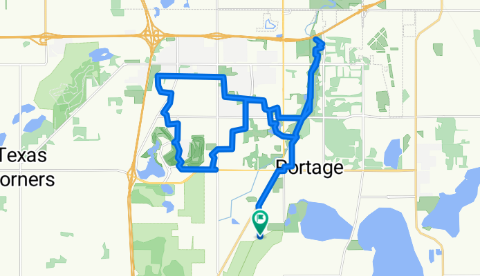
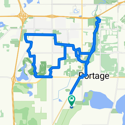
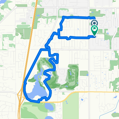
Portage Trail Ride - and down through Moors Golf Club and back to the trail
A cycling route starting in Portage, Michigan, United States.
Overview
About this route
Activity Type: Skate Skiing | Event Type: Recreation
Trikke on Portage paths, and a little exploration on some local streets and through the Moors golf club on the way back East.. There are some decent trails in the Moors, and along the North side of Old Centre Rd, but they are still no where near the calibar of the main Portage Trails maintained by the Portage Parks Department.. Instead of bringing any hydration pack, I just stopped at a couple gas stations for water - at the Shell, corner of Westnedge and Romence, and then for another bottle at BP on the corner of Oakland & Centre..
- 1 h 52 min
- Duration
- 30.9 km
- Distance
- 84 m
- Ascent
- 84 m
- Descent
- 16.5 km/h
- Avg. speed
- 284 m
- Max. altitude

Continue with Bikemap
Use, edit, or download this cycling route
You would like to ride Portage Trail Ride - and down through Moors Golf Club and back to the trail or customize it for your own trip? Here is what you can do with this Bikemap route:
Free features
- Save this route as favorite or in collections
- Copy & plan your own version of this route
- Sync your route with Garmin or Wahoo
Premium features
Free trial for 3 days, or one-time payment. More about Bikemap Premium.
- Navigate this route on iOS & Android
- Export a GPX / KML file of this route
- Create your custom printout (try it for free)
- Download this route for offline navigation
Discover more Premium features.
Get Bikemap PremiumFrom our community
Other popular routes starting in Portage
 5Mile Trails
- Distance
- 7.8 km
- Ascent
- 46 m
- Descent
- 42 m
- Location
- Portage, Michigan, United States
 Quick bike tour through Texas Corners
- Distance
- 5.8 km
- Ascent
- 95 m
- Descent
- 95 m
- Location
- Portage, Michigan, United States
 test miles
- Distance
- 3.2 km
- Ascent
- 18 m
- Descent
- 15 m
- Location
- Portage, Michigan, United States
 Portage Trail Ride - and down through Moors Golf Club and back to the trail
- Distance
- 30.9 km
- Ascent
- 84 m
- Descent
- 84 m
- Location
- Portage, Michigan, United States
 Garden Lane 7401, Portage to Garden Lane 7401, Portage
- Distance
- 41.7 km
- Ascent
- 403 m
- Descent
- 403 m
- Location
- Portage, Michigan, United States
 Brief bike tour through Portage
- Distance
- 9.7 km
- Ascent
- 16 m
- Descent
- 15 m
- Location
- Portage, Michigan, United States
 8.14mi Road Cycling
- Distance
- 13.7 km
- Ascent
- 0 m
- Descent
- 0 m
- Location
- Portage, Michigan, United States
 Short ride through Portage
- Distance
- 6 km
- Ascent
- 6 m
- Descent
- 5 m
- Location
- Portage, Michigan, United States
Open it in the app