

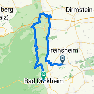
Bahnhofstraße 72, Erpolzheim nach Straße ohne Straßennamen, Bissersheim
A cycling route starting in Erpolzheim, Rhineland-Palatinate, Germany.
Overview
About this route
- 1 h 27 min
- Duration
- 21.2 km
- Distance
- 292 m
- Ascent
- 305 m
- Descent
- 14.6 km/h
- Avg. speed
- 318 m
- Max. altitude
Route quality
Waytypes & surfaces along the route
Waytypes
Track
15.8 km
(74 %)
Quiet road
2.8 km
(13 %)
Surfaces
Paved
13.9 km
(65 %)
Unpaved
5.6 km
(26 %)
Asphalt
10.1 km
(47 %)
Gravel
4 km
(19 %)
Continue with Bikemap
Use, edit, or download this cycling route
You would like to ride Bahnhofstraße 72, Erpolzheim nach Straße ohne Straßennamen, Bissersheim or customize it for your own trip? Here is what you can do with this Bikemap route:
Free features
- Save this route as favorite or in collections
- Copy & plan your own version of this route
- Sync your route with Garmin or Wahoo
Premium features
Free trial for 3 days, or one-time payment. More about Bikemap Premium.
- Navigate this route on iOS & Android
- Export a GPX / KML file of this route
- Create your custom printout (try it for free)
- Download this route for offline navigation
Discover more Premium features.
Get Bikemap PremiumFrom our community
Other popular routes starting in Erpolzheim
 Bad Dürkheim nach Hauptstraße 121A, Meckenheim
- Distance
- 12.6 km
- Ascent
- 42 m
- Descent
- 44 m
- Location
- Erpolzheim, Rhineland-Palatinate, Germany
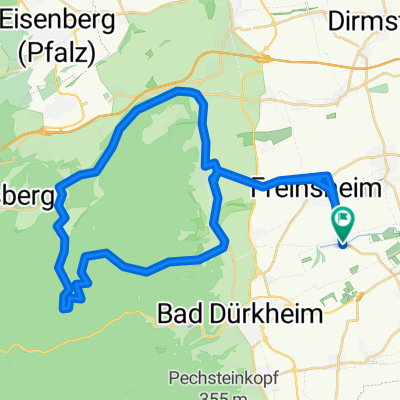
 Route mit Bratan Toni Teil 2
- Distance
- 29 km
- Ascent
- 334 m
- Descent
- 335 m
- Location
- Erpolzheim, Rhineland-Palatinate, Germany
 Peterskopfrunde ab Erpolzheim
- Distance
- 45 km
- Ascent
- 563 m
- Descent
- 563 m
- Location
- Erpolzheim, Rhineland-Palatinate, Germany
 Erpolzheim-Mußbach-NW-Hbf
- Distance
- 25.2 km
- Ascent
- 99 m
- Descent
- 64 m
- Location
- Erpolzheim, Rhineland-Palatinate, Germany
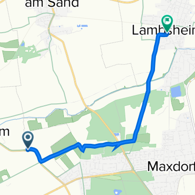 Hauptstraße, Bad Dürkheim nach Mühltorstraße 25, Lambsheim
- Distance
- 5.8 km
- Ascent
- 0 m
- Descent
- 3 m
- Location
- Erpolzheim, Rhineland-Palatinate, Germany
 awv-Trau22 Erpolzheim-Speyer-Heidelberg-Wormss
- Distance
- 296.3 km
- Ascent
- 1,117 m
- Descent
- 1,116 m
- Location
- Erpolzheim, Rhineland-Palatinate, Germany
 Bahnhofstraße 72, Erpolzheim nach Straße ohne Straßennamen, Bissersheim
- Distance
- 21.2 km
- Ascent
- 292 m
- Descent
- 305 m
- Location
- Erpolzheim, Rhineland-Palatinate, Germany
 Route nach Finkenweg
- Distance
- 49.2 km
- Ascent
- 1,014 m
- Descent
- 1,013 m
- Location
- Erpolzheim, Rhineland-Palatinate, Germany
Open it in the app