

Overview
About this route
- -:--
- Duration
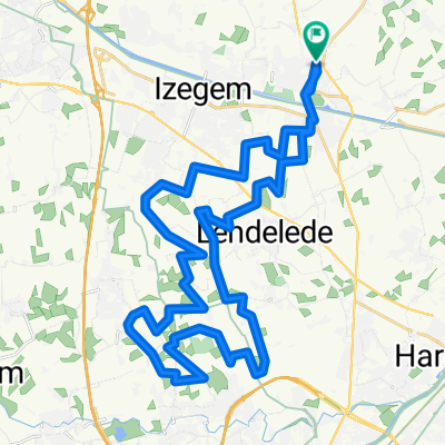
- 57.1 km
- Distance
- 120 m
- Ascent
- 121 m
- Descent
- ---
- Avg. speed
- 33 m
- Max. altitude

Part of
Beitem
4 stages
Route quality
Waytypes & surfaces along the route
Waytypes
Quiet road
51.8 km
(91 %)
Busy road
2.9 km
(5 %)
Surfaces
Paved
11.6 km
(20 %)
Unpaved
0.9 km
(2 %)
Asphalt
11.1 km
(19 %)
Loose gravel
0.9 km
(2 %)
Route highlights
Points of interest along the route
Point of interest after 7.7 km
desanto
Point of interest after 10.8 km
schoorsteen
Point of interest after 13.2 km
slechte macadam
Point of interest after 13.7 km
de roobaert
Point of interest after 15.4 km
zonnepanelen
Point of interest after 16.1 km
fruitbedrijf

Point of interest after 22.3 km
Point of interest after 26.2 km
bakkerij
Point of interest after 26.7 km
geen doorgang
Point of interest after 26.8 km
decathlon
Point of interest after 26.8 km
flamingofarm
Point of interest after 26.8 km
kapel met bank
Point of interest after 27.3 km
kassei
Point of interest after 27.3 km
watertoren
Point of interest after 28.3 km
kleiputten
Point of interest after 31.1 km
hofstee

Point of interest after 31.8 km
kapel met 2 banken
Point of interest after 33.1 km
mooie dreef
Point of interest after 34.8 km
groendal
Point of interest after 40.8 km
schapenweide
Point of interest after 41.6 km
oude god
Point of interest after 41.9 km
dubois
Point of interest after 44.8 km
klare gracht
Point of interest after 47.8 km
leenstraat
Point of interest after 49.5 km
geen doorgang
Point of interest after 50 km
hacienda
Continue with Bikemap
Use, edit, or download this cycling route
You would like to ride beitem3 - 57.1 or customize it for your own trip? Here is what you can do with this Bikemap route:
Free features
- Save this route as favorite or in collections
- Copy & plan your own version of this route
- Sync your route with Garmin or Wahoo
Premium features
Free trial for 3 days, or one-time payment. More about Bikemap Premium.
- Navigate this route on iOS & Android
- Export a GPX / KML file of this route
- Create your custom printout (try it for free)
- Download this route for offline navigation
Discover more Premium features.
Get Bikemap PremiumFrom our community
Other popular routes starting in Ingelmunster
 poelbergZ totaal - 1-2-3-4
- Distance
- 200.7 km
- Ascent
- 528 m
- Descent
- 525 m
- Location
- Ingelmunster, Flemish Region, Belgium
 hulsteZ1 - 29.4
- Distance
- 29.3 km
- Ascent
- 108 m
- Descent
- 111 m
- Location
- Ingelmunster, Flemish Region, Belgium
 roeselare3 - 44.4
- Distance
- 44.4 km
- Ascent
- 102 m
- Descent
- 101 m
- Location
- Ingelmunster, Flemish Region, Belgium
 knooppunten 1 - 9
- Distance
- 356.4 km
- Ascent
- 112 m
- Descent
- 109 m
- Location
- Ingelmunster, Flemish Region, Belgium
 heule vandaag - 38.6
- Distance
- 38.6 km
- Ascent
- 120 m
- Descent
- 120 m
- Location
- Ingelmunster, Flemish Region, Belgium
 meulebekeZ1 - 26.8
- Distance
- 26.8 km
- Ascent
- 42 m
- Descent
- 42 m
- Location
- Ingelmunster, Flemish Region, Belgium
 meulebekeZ3 - 35.7
- Distance
- 35.7 km
- Ascent
- 71 m
- Descent
- 71 m
- Location
- Ingelmunster, Flemish Region, Belgium
 meulebekeZ totaal 1-2-3-4-5-6-7
- Distance
- 249.8 km
- Ascent
- 164 m
- Descent
- 165 m
- Location
- Ingelmunster, Flemish Region, Belgium
Open it in the app