
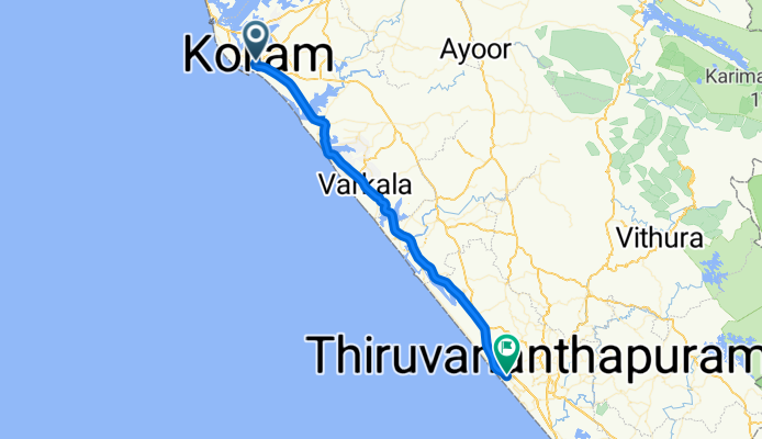
Salem-Kanyakumari Highway, Kollam to Tab Medical Lane, Bangalore
A cycling route starting in Kollam, Kerala, India.
Overview
About this route
- 1 h 12 min
- Duration
- 57.7 km
- Distance
- 331 m
- Ascent
- 337 m
- Descent
- 48.4 km/h
- Avg. speed
- 91 m
- Max. altitude

Continue with Bikemap
Use, edit, or download this cycling route
You would like to ride Salem-Kanyakumari Highway, Kollam to Tab Medical Lane, Bangalore or customize it for your own trip? Here is what you can do with this Bikemap route:
Free features
- Save this route as favorite or in collections
- Copy & plan your own version of this route
- Sync your route with Garmin or Wahoo
Premium features
Free trial for 3 days, or one-time payment. More about Bikemap Premium.
- Navigate this route on iOS & Android
- Export a GPX / KML file of this route
- Create your custom printout (try it for free)
- Download this route for offline navigation
Discover more Premium features.
Get Bikemap PremiumFrom our community
Other popular routes starting in Kollam
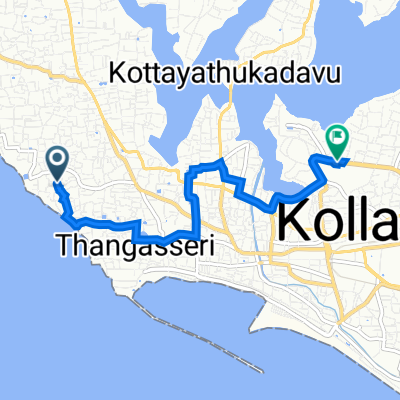
 VHV5+WWQ, Kollam to VHWV+89R, Kollam
- Distance
- 10.9 km
- Ascent
- 55 m
- Descent
- 46 m
- Location
- Kollam, Kerala, India
 india 13
- Distance
- 69 km
- Ascent
- 264 m
- Descent
- 249 m
- Location
- Kollam, Kerala, India
 Trial Run Micro
- Distance
- 4.9 km
- Ascent
- 8 m
- Descent
- 9 m
- Location
- Kollam, Kerala, India
 Salem-Kanyakumari Highway, Kollam to Tab Medical Lane, Bangalore
- Distance
- 57.7 km
- Ascent
- 331 m
- Descent
- 337 m
- Location
- Kollam, Kerala, India
 VHV5+86C, Kollam to VHWV+F22, Kollam
- Distance
- 6.9 km
- Ascent
- 47 m
- Descent
- 42 m
- Location
- Kollam, Kerala, India
 Thirumullavaram Road, Kollam to VHPG+X4G, Kollam
- Distance
- 15.1 km
- Ascent
- 68 m
- Descent
- 64 m
- Location
- Kollam, Kerala, India
 Kollam to WJ22+MMF, Kollam
- Distance
- 23.4 km
- Ascent
- 155 m
- Descent
- 160 m
- Location
- Kollam, Kerala, India
 Palamukku – Nallila Road to MWP4+F3H, Vagamon
- Distance
- 142.7 km
- Ascent
- 4,135 m
- Descent
- 3,164 m
- Location
- Kollam, Kerala, India
Open it in the app