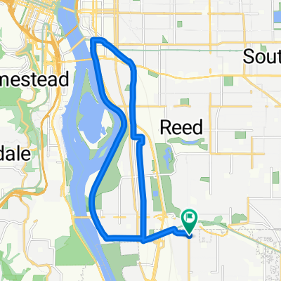
4942 SE 28th Ave, Portland to 4952 SE 28th Ave, Portland
A cycling route starting in Milwaukie, Oregon, United States.
Overview
About this route
- 2 h 58 min
- Duration
- 10 km
- Distance
- 125 m
- Ascent
- 123 m
- Descent
- 3.4 km/h
- Avg. speed
- 45 m
- Max. altitude
Route photos
Route quality
Waytypes & surfaces along the route
Waytypes
Road
6 km
(60 %)
Path
1.4 km
(14 %)
Surfaces
Paved
7.3 km
(73 %)
Asphalt
4.6 km
(46 %)
Paved (undefined)
2.5 km
(25 %)
Continue with Bikemap
Use, edit, or download this cycling route
You would like to ride 4942 SE 28th Ave, Portland to 4952 SE 28th Ave, Portland or customize it for your own trip? Here is what you can do with this Bikemap route:
Free features
- Save this route as favorite or in collections
- Copy & plan your own version of this route
- Sync your route with Garmin or Wahoo
Premium features
Free trial for 3 days, or one-time payment. More about Bikemap Premium.
- Navigate this route on iOS & Android
- Export a GPX / KML file of this route
- Create your custom printout (try it for free)
- Download this route for offline navigation
Discover more Premium features.
Get Bikemap PremiumFrom our community
Other popular routes starting in Milwaukie
- Lake Oswego loop
- Distance
- 36.5 km
- Ascent
- 569 m
- Descent
- 665 m
- Location
- Milwaukie, Oregon, United States
- October 24, 2:34 PM Springwater trail along Willamette
- Distance
- 19 km
- Ascent
- 156 m
- Descent
- 155 m
- Location
- Milwaukie, Oregon, United States
- 4942 SE 28th Ave, Portland to 4952 SE 28th Ave, Portland
- Distance
- 10 km
- Ascent
- 125 m
- Descent
- 123 m
- Location
- Milwaukie, Oregon, United States
- Route to 5675 SE International Way, Portland
- Distance
- 9.7 km
- Ascent
- 0 m
- Descent
- 8 m
- Location
- Milwaukie, Oregon, United States
- Easy ride in Portland
- Distance
- 19.1 km
- Ascent
- 173 m
- Descent
- 123 m
- Location
- Milwaukie, Oregon, United States
- Butterfly Park and Spring Water Corridor
- Distance
- 18 km
- Ascent
- 244 m
- Descent
- 73 m
- Location
- Milwaukie, Oregon, United States
- loopy loop around the river
- Distance
- 17.9 km
- Ascent
- 106 m
- Descent
- 106 m
- Location
- Milwaukie, Oregon, United States
- Willamette Greenway to Tillicum loop
- Distance
- 16.6 km
- Ascent
- 118 m
- Descent
- 131 m
- Location
- Milwaukie, Oregon, United States
Open it in the app