

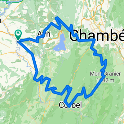
35 Chemin des Carmes, Le Pont-de-Beauvoisin to 35 Chemin des Carmes, Le Pont-de-Beauvoisin
A cycling route starting in Le Pont-de-Beauvoisin, Auvergne-Rhône-Alpes, France.
Overview
About this route
- 19 min
- Duration
- 3.9 km
- Distance
- 53 m
- Ascent
- 53 m
- Descent
- 12.6 km/h
- Avg. speed
- 305 m
- Max. altitude
Route quality
Waytypes & surfaces along the route
Waytypes
Quiet road
3.8 km
(96 %)
Access road
0.2 km
(4 %)
Undefined
0 km
(<1 %)
Surfaces
Paved
2.7 km
(69 %)
Asphalt
2.7 km
(69 %)
Undefined
1.2 km
(31 %)
Continue with Bikemap
Use, edit, or download this cycling route
You would like to ride 35 Chemin des Carmes, Le Pont-de-Beauvoisin to 35 Chemin des Carmes, Le Pont-de-Beauvoisin or customize it for your own trip? Here is what you can do with this Bikemap route:
Free features
- Save this route as favorite or in collections
- Copy & plan your own version of this route
- Sync your route with Garmin or Wahoo
Premium features
Free trial for 3 days, or one-time payment. More about Bikemap Premium.
- Navigate this route on iOS & Android
- Export a GPX / KML file of this route
- Create your custom printout (try it for free)
- Download this route for offline navigation
Discover more Premium features.
Get Bikemap PremiumFrom our community
Other popular routes starting in Le Pont-de-Beauvoisin
 Aux alentours de Pont de Beauvoisin
- Distance
- 87.7 km
- Ascent
- 1,748 m
- Descent
- 1,748 m
- Location
- Le Pont-de-Beauvoisin, Auvergne-Rhône-Alpes, France
 Lac d'Aiguebelette
- Distance
- 92.5 km
- Ascent
- 1,812 m
- Descent
- 1,812 m
- Location
- Le Pont-de-Beauvoisin, Auvergne-Rhône-Alpes, France
 Recon 2
- Distance
- 34.9 km
- Ascent
- 336 m
- Descent
- 337 m
- Location
- Le Pont-de-Beauvoisin, Auvergne-Rhône-Alpes, France
 Belmont-Tramonet Recon
- Distance
- 33.9 km
- Ascent
- 438 m
- Descent
- 437 m
- Location
- Le Pont-de-Beauvoisin, Auvergne-Rhône-Alpes, France
 Circuit du Nord-Pays Voironnais
- Distance
- 77.5 km
- Ascent
- 999 m
- Descent
- 991 m
- Location
- Le Pont-de-Beauvoisin, Auvergne-Rhône-Alpes, France
 Grand Tour I 2018
- Distance
- 108.9 km
- Ascent
- 2,485 m
- Descent
- 2,485 m
- Location
- Le Pont-de-Beauvoisin, Auvergne-Rhône-Alpes, France
 La Chartreuse 6ème j
- Distance
- 58 km
- Ascent
- 1,245 m
- Descent
- 1,272 m
- Location
- Le Pont-de-Beauvoisin, Auvergne-Rhône-Alpes, France
 warm up loop
- Distance
- 16.4 km
- Ascent
- 399 m
- Descent
- 401 m
- Location
- Le Pont-de-Beauvoisin, Auvergne-Rhône-Alpes, France
Open it in the app