

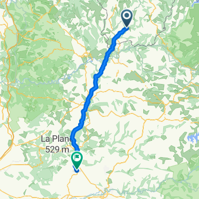
De Avenue de L’Egalite 5, Boisset à Chemin du Château Vieux 2, Velzic
A cycling route starting in Maurs, Auvergne-Rhône-Alpes, France.
Overview
About this route
- 3 h 33 min
- Duration
- 51.1 km
- Distance
- 1,188 m
- Ascent
- 882 m
- Descent
- 14.4 km/h
- Avg. speed
- 726 m
- Max. altitude
Route quality
Waytypes & surfaces along the route
Waytypes
Road
16.3 km
(32 %)
Quiet road
3.6 km
(7 %)
Surfaces
Paved
28.1 km
(55 %)
Asphalt
28.1 km
(55 %)
Undefined
23 km
(45 %)
Continue with Bikemap
Use, edit, or download this cycling route
You would like to ride De Avenue de L’Egalite 5, Boisset à Chemin du Château Vieux 2, Velzic or customize it for your own trip? Here is what you can do with this Bikemap route:
Free features
- Save this route as favorite or in collections
- Copy & plan your own version of this route
- Sync your route with Garmin or Wahoo
Premium features
Free trial for 3 days, or one-time payment. More about Bikemap Premium.
- Navigate this route on iOS & Android
- Export a GPX / KML file of this route
- Create your custom printout (try it for free)
- Download this route for offline navigation
Discover more Premium features.
Get Bikemap PremiumFrom our community
Other popular routes starting in Maurs
 Recovered Route
- Distance
- 37.4 km
- Ascent
- 806 m
- Descent
- 598 m
- Location
- Maurs, Auvergne-Rhône-Alpes, France
 conques
- Distance
- 87.7 km
- Ascent
- 1,355 m
- Descent
- 1,355 m
- Location
- Maurs, Auvergne-Rhône-Alpes, France
 cantal 18
- Distance
- 85.9 km
- Ascent
- 992 m
- Descent
- 1,001 m
- Location
- Maurs, Auvergne-Rhône-Alpes, France
 cele
cele- Distance
- 47.5 km
- Ascent
- 231 m
- Descent
- 353 m
- Location
- Maurs, Auvergne-Rhône-Alpes, France
 De Linac à Linac
- Distance
- 25.6 km
- Ascent
- 791 m
- Descent
- 792 m
- Location
- Maurs, Auvergne-Rhône-Alpes, France
 Steady ride in Cajarc
- Distance
- 55.2 km
- Ascent
- 649 m
- Descent
- 784 m
- Location
- Maurs, Auvergne-Rhône-Alpes, France
 199906: Mours - St Jory
- Distance
- 195.4 km
- Ascent
- 2,474 m
- Descent
- 2,650 m
- Location
- Maurs, Auvergne-Rhône-Alpes, France
 Maurs - Cordes-sur-Ciel
- Distance
- 103.1 km
- Ascent
- 2,311 m
- Descent
- 2,534 m
- Location
- Maurs, Auvergne-Rhône-Alpes, France
Open it in the app