

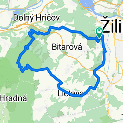
Po Modrej k Hucerovcom
A cycling route starting in Žilina, Žilina Region, Slovakia.
Overview
About this route
Route ridden on 7.11 without a GPS device. It was therefore drawn approximately. The path follows the blue tourist mark.
- -:--
- Duration
- 20.8 km
- Distance
- 647 m
- Ascent
- 647 m
- Descent
- ---
- Avg. speed
- ---
- Max. altitude

Route highlights
Points of interest along the route

Point of interest after 1 km

Point of interest after 1.9 km

Point of interest after 2.3 km

Point of interest after 3.3 km

Point of interest after 6.5 km

Point of interest after 7.9 km

Point of interest after 11.5 km
Continue with Bikemap
Use, edit, or download this cycling route
You would like to ride Po Modrej k Hucerovcom or customize it for your own trip? Here is what you can do with this Bikemap route:
Free features
- Save this route as favorite or in collections
- Copy & plan your own version of this route
- Sync your route with Garmin or Wahoo
Premium features
Free trial for 3 days, or one-time payment. More about Bikemap Premium.
- Navigate this route on iOS & Android
- Export a GPX / KML file of this route
- Create your custom printout (try it for free)
- Download this route for offline navigation
Discover more Premium features.
Get Bikemap PremiumFrom our community
Other popular routes starting in Žilina
 Nedeľný výjazd 11.6.2017
- Distance
- 32.1 km
- Ascent
- 716 m
- Descent
- 716 m
- Location
- Žilina, Žilina Region, Slovakia
 Kaštiele (ľahká) mediamatika
- Distance
- 18.4 km
- Ascent
- 95 m
- Descent
- 121 m
- Location
- Žilina, Žilina Region, Slovakia
 MTbiker trasa ponad Rajecke Teplice
- Distance
- 32.2 km
- Ascent
- 653 m
- Descent
- 689 m
- Location
- Žilina, Žilina Region, Slovakia
 Jánošíkovým krajom (stredná) mediamatika
- Distance
- 28.6 km
- Ascent
- 373 m
- Descent
- 93 m
- Location
- Žilina, Žilina Region, Slovakia
 Pekná príroda, výhľady, kaplnky a viac (ľahká) mediamatika
- Distance
- 19.4 km
- Ascent
- 187 m
- Descent
- 138 m
- Location
- Žilina, Žilina Region, Slovakia
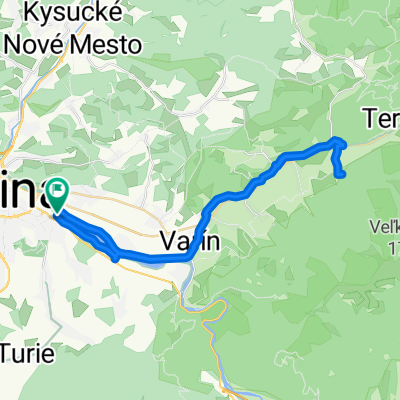 Route in Teplička nad Váhom
- Distance
- 43.9 km
- Ascent
- 284 m
- Descent
- 284 m
- Location
- Žilina, Žilina Region, Slovakia
 Battle of 5 countries
- Distance
- 401.9 km
- Ascent
- 784 m
- Descent
- 973 m
- Location
- Žilina, Žilina Region, Slovakia
 Vodné dielo - Budatin
- Distance
- 16.8 km
- Ascent
- 68 m
- Descent
- 64 m
- Location
- Žilina, Žilina Region, Slovakia
Open it in the app