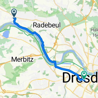
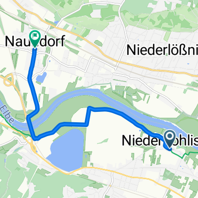
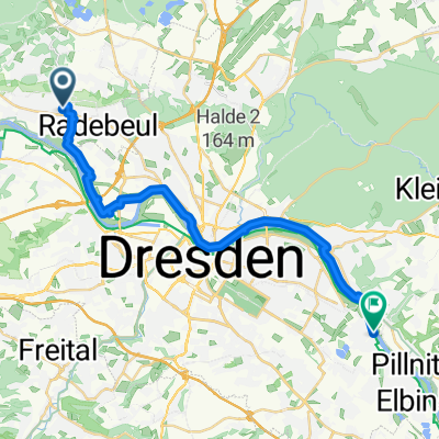
Radebeul - Ründchen Friedewald - Dippelsdorf - Moritzburg - Bärnsdorf - Volkersdorf - Altklotsche - Hellerau - Rähnitz - Wilschdorf - Boxdorf und zurück 2023
A cycling route starting in Radebeul, Saxony, Germany.
Overview
About this route
Radebeul - Ründchen Friedewald - Dippelsdorf - Moritzburg - Bärnsdorf - Volkersdorf - Altklotsche - Hellerau - Rähnitz - Wilschdorf - Boxdorf und zurück Startpunkt: Radisson Blu Park Hotel & Conference Centre, Nizzastraße 55, 01445 Radebeul (D)
- -:--
- Duration
- 39 km
- Distance
- 553 m
- Ascent
- 550 m
- Descent
- ---
- Avg. speed
- 285 m
- Max. altitude
Route quality
Waytypes & surfaces along the route
Waytypes
Quiet road
12.5 km
(32 %)
Road
10.4 km
(27 %)
Surfaces
Paved
28.3 km
(73 %)
Unpaved
7.6 km
(19 %)
Asphalt
27.3 km
(70 %)
Gravel
3.2 km
(8 %)
Continue with Bikemap
Use, edit, or download this cycling route
You would like to ride Radebeul - Ründchen Friedewald - Dippelsdorf - Moritzburg - Bärnsdorf - Volkersdorf - Altklotsche - Hellerau - Rähnitz - Wilschdorf - Boxdorf und zurück 2023 or customize it for your own trip? Here is what you can do with this Bikemap route:
Free features
- Save this route as favorite or in collections
- Copy & plan your own version of this route
- Sync your route with Garmin or Wahoo
Premium features
Free trial for 3 days, or one-time payment. More about Bikemap Premium.
- Navigate this route on iOS & Android
- Export a GPX / KML file of this route
- Create your custom printout (try it for free)
- Download this route for offline navigation
Discover more Premium features.
Get Bikemap PremiumFrom our community
Other popular routes starting in Radebeul
- Ausflug zum Fiedlergrund
- Distance
- 22 km
- Ascent
- 388 m
- Descent
- 386 m
- Location
- Radebeul, Saxony, Germany
- Briesnitz Dörfertour
- Distance
- 58.8 km
- Ascent
- 549 m
- Descent
- 451 m
- Location
- Radebeul, Saxony, Germany
- Radebeul - Ründchen Friedewald - Dippelsdorf - Moritzburg - Bärnsdorf - Volkersdorf - Altklotsche - Hellerau - Rähnitz - Wilschdorf - Boxdorf und zurück 2023
- Distance
- 39 km
- Ascent
- 553 m
- Descent
- 550 m
- Location
- Radebeul, Saxony, Germany
- Linkselbische Täler
- Distance
- 88.8 km
- Ascent
- 880 m
- Descent
- 888 m
- Location
- Radebeul, Saxony, Germany
- Reichenberg-Kalkreuth
- Distance
- 41.2 km
- Ascent
- 133 m
- Descent
- 158 m
- Location
- Radebeul, Saxony, Germany
- Radebeul-Bärwalde-Volkersdorf-Radebeul
- Distance
- 35.3 km
- Ascent
- 188 m
- Descent
- 188 m
- Location
- Radebeul, Saxony, Germany
- An der Festwiese 1, Radebeul nach Uferstraße 10, Radebeul
- Distance
- 47.3 km
- Ascent
- 85 m
- Descent
- 92 m
- Location
- Radebeul, Saxony, Germany
- Moritzburgrunde 45 km
- Distance
- 45 km
- Ascent
- 195 m
- Descent
- 200 m
- Location
- Radebeul, Saxony, Germany
Open it in the app