

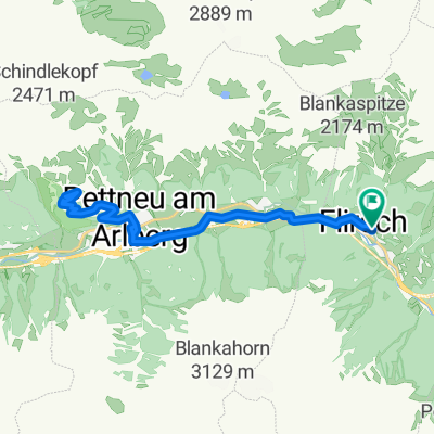
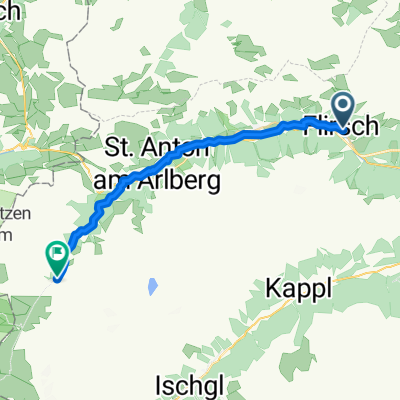
Runde von Flirsch nach St. Anton
A cycling route starting in Flirsch, Tyrol, Austria.
Overview
About this route
It is Tour No. 9 'Discovery Journey through the Stanzertal' in the new 'Tyrolean Cycling Book'
- 2 h 16 min
- Duration
- 26 km
- Distance
- 359 m
- Ascent
- 359 m
- Descent
- 11.5 km/h
- Avg. speed
- 1,309 m
- Max. altitude

Route quality
Waytypes & surfaces along the route
Waytypes
Track
14 km
(54 %)
Quiet road
10.1 km
(39 %)
Surfaces
Paved
21.3 km
(82 %)
Unpaved
3.9 km
(15 %)
Asphalt
21.1 km
(81 %)
Unpaved (undefined)
2.3 km
(9 %)
Continue with Bikemap
Use, edit, or download this cycling route
You would like to ride Runde von Flirsch nach St. Anton or customize it for your own trip? Here is what you can do with this Bikemap route:
Free features
- Save this route as favorite or in collections
- Copy & plan your own version of this route
- Sync your route with Garmin or Wahoo
Premium features
Free trial for 3 days, or one-time payment. More about Bikemap Premium.
- Navigate this route on iOS & Android
- Export a GPX / KML file of this route
- Create your custom printout (try it for free)
- Download this route for offline navigation
Discover more Premium features.
Get Bikemap PremiumFrom our community
Other popular routes starting in Flirsch
 Berghaus Maria - Arlberg Killer runde
- Distance
- 83.2 km
- Ascent
- 2,744 m
- Descent
- 2,744 m
- Location
- Flirsch, Tyrol, Austria
 Putzenalm - Darmstätter Hütte - Rendlalm
- Distance
- 50.7 km
- Ascent
- 1,906 m
- Descent
- 1,904 m
- Location
- Flirsch, Tyrol, Austria
 Berghaus Maria - Putzenalm - Verwallstauseerunde
- Distance
- 34.6 km
- Ascent
- 829 m
- Descent
- 828 m
- Location
- Flirsch, Tyrol, Austria
 Von Pettneu zum Flexenpass
- Distance
- 39.2 km
- Ascent
- 973 m
- Descent
- 973 m
- Location
- Flirsch, Tyrol, Austria
 Berghaus Maria - Putzenalm - Verwallstausee - Sattelweg
- Distance
- 37.1 km
- Ascent
- 1,067 m
- Descent
- 1,068 m
- Location
- Flirsch, Tyrol, Austria
 Flirsch– Nessleralm u. zurück
- Distance
- 19.9 km
- Ascent
- 466 m
- Descent
- 465 m
- Location
- Flirsch, Tyrol, Austria
 Runde über Silvretta-Hochalpenstraße
- Distance
- 147.1 km
- Ascent
- 2,331 m
- Descent
- 2,331 m
- Location
- Flirsch, Tyrol, Austria
 Flirsch, Flirsch nach Alter Verwall, St. Anton Am Arlberg
- Distance
- 24.1 km
- Ascent
- 970 m
- Descent
- 413 m
- Location
- Flirsch, Tyrol, Austria
Open it in the app