

Kuźmina-Tyrawa-Przełęcz Przysłup/punkt widokowy/
A cycling route starting in Tyrawa Wołoska, Subcarpathian Voivodeship, Poland.
Overview
About this route
jedne z najdłuższych lub najdłuższe serpentyny w Polsce na drodze krajowej nr 28
- -:--
- Duration
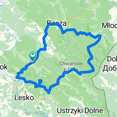
- 13.5 km
- Distance
- 319 m
- Ascent
- 205 m
- Descent
- ---
- Avg. speed
- ---
- Max. altitude

Continue with Bikemap
Use, edit, or download this cycling route
You would like to ride Kuźmina-Tyrawa-Przełęcz Przysłup/punkt widokowy/ or customize it for your own trip? Here is what you can do with this Bikemap route:
Free features
- Save this route as favorite or in collections
- Copy & plan your own version of this route
- Sync your route with Garmin or Wahoo
Premium features
Free trial for 3 days, or one-time payment. More about Bikemap Premium.
- Navigate this route on iOS & Android
- Export a GPX / KML file of this route
- Create your custom printout (try it for free)
- Download this route for offline navigation
Discover more Premium features.
Get Bikemap PremiumFrom our community
Other popular routes starting in Tyrawa Wołoska
 Słonne - Szybowisko
- Distance
- 110.9 km
- Ascent
- 1,322 m
- Descent
- 1,334 m
- Location
- Tyrawa Wołoska, Subcarpathian Voivodeship, Poland
 Pogórze
- Distance
- 98.2 km
- Ascent
- 1,098 m
- Descent
- 1,146 m
- Location
- Tyrawa Wołoska, Subcarpathian Voivodeship, Poland
 Diabla Góra - Przemyśl
- Distance
- 100.6 km
- Ascent
- 729 m
- Descent
- 803 m
- Location
- Tyrawa Wołoska, Subcarpathian Voivodeship, Poland
 Kuźmina-Tyrawa-Przełęcz Przysłup/punkt widokowy/
- Distance
- 13.5 km
- Ascent
- 319 m
- Descent
- 205 m
- Location
- Tyrawa Wołoska, Subcarpathian Voivodeship, Poland
 Tyrawa
- Distance
- 37.8 km
- Ascent
- 647 m
- Descent
- 655 m
- Location
- Tyrawa Wołoska, Subcarpathian Voivodeship, Poland
 Trzcianiec
- Distance
- 31.8 km
- Ascent
- 586 m
- Descent
- 580 m
- Location
- Tyrawa Wołoska, Subcarpathian Voivodeship, Poland
 Tyrawa Solna - Łodyna - Stoły - Bezmiechowa
- Distance
- 82.7 km
- Ascent
- 883 m
- Descent
- 884 m
- Location
- Tyrawa Wołoska, Subcarpathian Voivodeship, Poland
 Borownica-Siedliska
- Distance
- 46 km
- Ascent
- 303 m
- Descent
- 304 m
- Location
- Tyrawa Wołoska, Subcarpathian Voivodeship, Poland
Open it in the app