
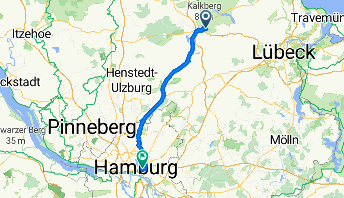
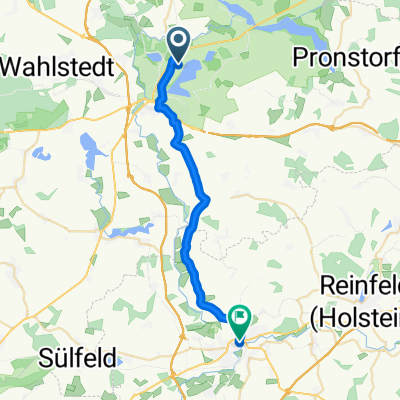
Kastanienweg 8, Bad Segeberg nach Wikingerweg 2, Hamburg
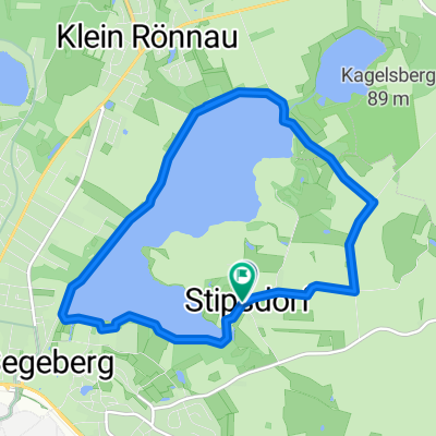
A cycling route starting in Stipsdorf, Schleswig-Holstein, Germany.
Overview
About this route
- 3 h 25 min
- Duration
- 56.4 km
- Distance
- 176 m
- Ascent
- 208 m
- Descent
- 16.5 km/h
- Avg. speed
- 58 m
- Avg. speed

Route quality
Waytypes & surfaces along the route
Waytypes
Path
27.3 km
(48 %)
Busy road
14.6 km
(26 %)
Surfaces
Paved
44.3 km
(79 %)
Unpaved
0.2 km
(<1 %)
Asphalt
40.2 km
(71 %)
Paving stones
3.6 km
(6 %)
Continue with Bikemap
Use, edit, or download this cycling route
You would like to ride Kastanienweg 8, Bad Segeberg nach Wikingerweg 2, Hamburg or customize it for your own trip? Here is what you can do with this Bikemap route:
Free features
- Save this route as favorite or in collections
- Copy & plan your own version of this route
- Sync your route with Garmin or Wahoo
Premium features
Free trial for 3 days, or one-time payment. More about Bikemap Premium.
- Navigate this route on iOS & Android
- Export a GPX / KML file of this route
- Create your custom printout (try it for free)
- Download this route for offline navigation
Discover more Premium features.
Get Bikemap PremiumFrom our community
Other popular routes starting in Stipsdorf
 Rund um den Segeberger See
- Distance
- 26.3 km
- Ascent
- 104 m
- Descent
- 104 m
- Location
- Stipsdorf, Schleswig-Holstein, Germany
 Ostsee 2019 BS->Scharbeutz
- Distance
- 41.5 km
- Ascent
- 149 m
- Descent
- 185 m
- Location
- Stipsdorf, Schleswig-Holstein, Germany
 Segeberger See Wanderweg (12,5km)
- Distance
- 12.3 km
- Ascent
- 89 m
- Descent
- 90 m
- Location
- Stipsdorf, Schleswig-Holstein, Germany
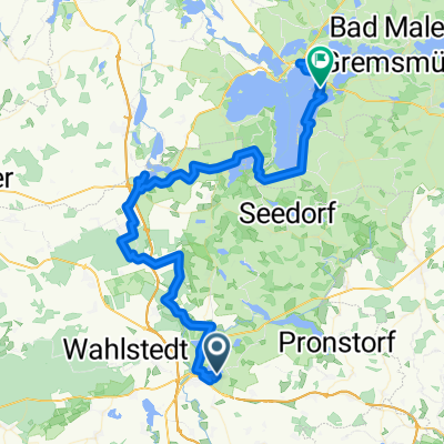
 Seeweg 15A, Stipsdorf nach Schulstraße 8, Klein Rönnau
- Distance
- 50.9 km
- Ascent
- 0 m
- Descent
- 37 m
- Location
- Stipsdorf, Schleswig-Holstein, Germany
 KlüthseeCamp nach Wildpark Eekholt
- Distance
- 27.2 km
- Ascent
- 117 m
- Descent
- 141 m
- Location
- Stipsdorf, Schleswig-Holstein, Germany
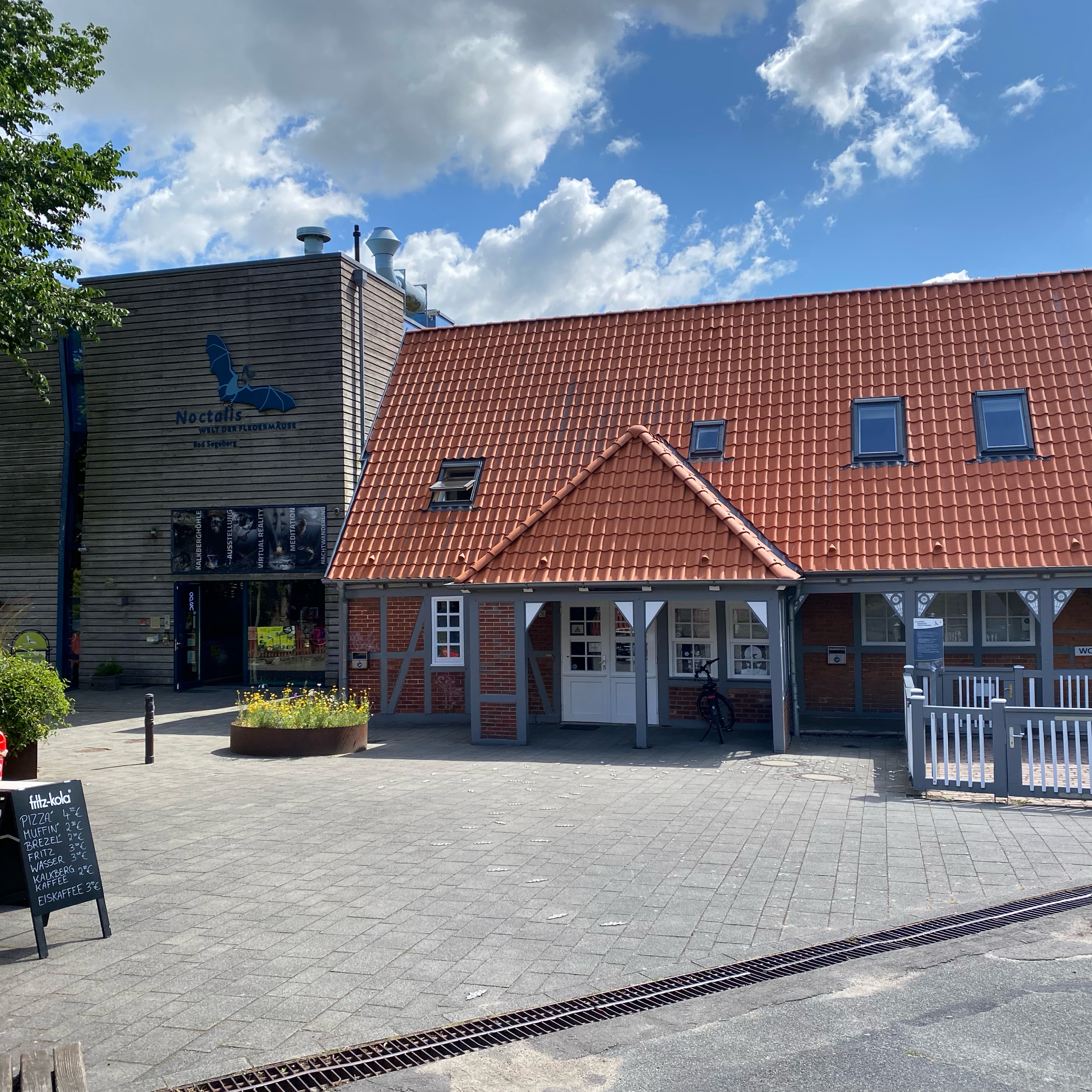 KlüthseeCamp nach Noctalis in Bad Segeberg
- Distance
- 6.4 km
- Ascent
- 70 m
- Descent
- 59 m
- Location
- Stipsdorf, Schleswig-Holstein, Germany
 Mönchsweg / 4. Etappe
- Distance
- 73.4 km
- Ascent
- 194 m
- Descent
- 198 m
- Location
- Stipsdorf, Schleswig-Holstein, Germany
 Oldesloe
- Distance
- 21.3 km
- Ascent
- 80 m
- Descent
- 107 m
- Location
- Stipsdorf, Schleswig-Holstein, Germany
Open it in the app