

Fernando 12
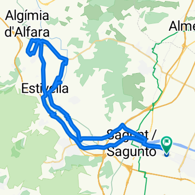
A cycling route starting in Sagunto, Valencia, Spain.
Overview
About this route
A very beautiful route not suitable for Sunday riders. Good asphalt for the most part. Several fountains scattered. You will climb 2 passes, Xiribilla for its height and Oronet for Serra. You will enjoy a great descent that starts in Xiribilla and ends in Bétera.
- -:--
- Duration
- 153.1 km
- Distance
- 1,259 m
- Ascent
- 1,259 m
- Descent
- ---
- Avg. speed
- ---
- Max. altitude
Continue with Bikemap
Use, edit, or download this cycling route
You would like to ride Fernando 12 or customize it for your own trip? Here is what you can do with this Bikemap route:
Free features
- Save this route as favorite or in collections
- Copy & plan your own version of this route
- Split it into stages to create a multi-day tour
- Sync your route with Garmin or Wahoo
Premium features
Free trial for 3 days, or one-time payment. More about Bikemap Premium.
- Navigate this route on iOS & Android
- Export a GPX / KML file of this route
- Create your custom printout (try it for free)
- Download this route for offline navigation
Discover more Premium features.
Get Bikemap PremiumFrom our community
Other popular routes starting in Sagunto
 SAGUNTO PICAYO LA MOLA
- Distance
- 29.1 km
- Ascent
- 566 m
- Descent
- 567 m
- Location
- Sagunto, Valencia, Spain
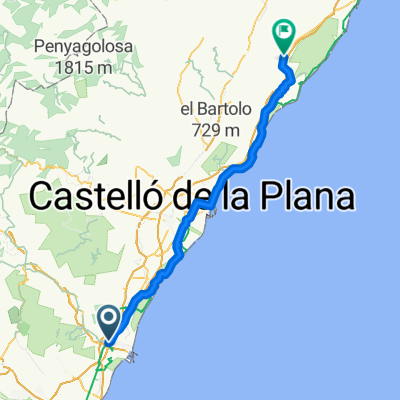
 ALFORJAS POR CASTELLÓN
- Distance
- 344.1 km
- Ascent
- 3,486 m
- Descent
- 3,522 m
- Location
- Sagunto, Valencia, Spain
 Sagunto circular por Alfara y Torres Torres
- Distance
- 40.3 km
- Ascent
- 403 m
- Descent
- 402 m
- Location
- Sagunto, Valencia, Spain
 dave77: Sagunto - Peñas de Guaita - Santo Espiritu - Gilet - Sagunto (variante x Rafa)
- Distance
- 18.2 km
- Ascent
- 347 m
- Descent
- 347 m
- Location
- Sagunto, Valencia, Spain
 puerto sagunto-aqüeducte dels arcs-torres torres-puerto sagunto-
- Distance
- 38.2 km
- Ascent
- 313 m
- Descent
- 310 m
- Location
- Sagunto, Valencia, Spain
 La bergonzosa
- Distance
- 57.9 km
- Ascent
- 747 m
- Descent
- 747 m
- Location
- Sagunto, Valencia, Spain
 Sagunto - Antenas Picayo - Pico Aguila - Mola - Xocainet - Gilet -Sagunto
- Distance
- 34.7 km
- Ascent
- 709 m
- Descent
- 709 m
- Location
- Sagunto, Valencia, Spain
 Sagunto - Alcalà de Xivert
- Distance
- 99.6 km
- Ascent
- 379 m
- Descent
- 269 m
- Location
- Sagunto, Valencia, Spain
Open it in the app