

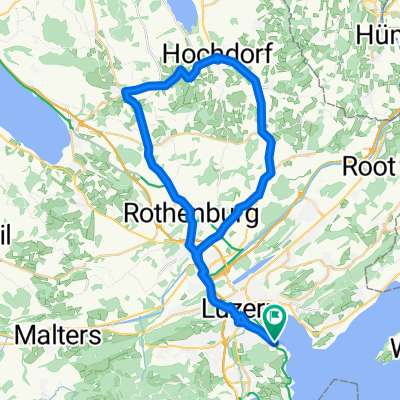
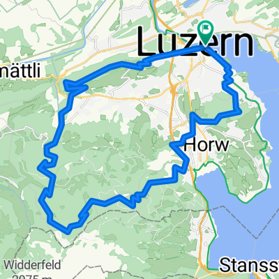
**02-D. Luzern - Gstadd (141,5 Km)
A cycling route starting in Lucerne, Canton of Lucerne, Switzerland.
Overview
About this route
- -:--
- Duration
- 141.3 km
- Distance
- 2,502 m
- Ascent
- 1,893 m
- Descent
- ---
- Avg. speed
- 1,280 m
- Max. altitude
Route quality
Waytypes & surfaces along the route
Waytypes
Quiet road
12.7 km
(9 %)
Cycleway
11.3 km
(8 %)
Surfaces
Paved
66.4 km
(47 %)
Unpaved
5.7 km
(4 %)
Asphalt
65 km
(46 %)
Gravel
5.7 km
(4 %)
Route highlights
Points of interest along the route
\"")
Point of interest after 64.6 km
SCHALLENBERG Pass (2) Km 64,5 · 1.167 m
Point of interest after 85 km
Sprint THUN Km 84,5
\"")
Point of interest after 132.9 km
SAANENMÖSER (2) Km 133 · 1.279 m
Continue with Bikemap
Use, edit, or download this cycling route
You would like to ride **02-D. Luzern - Gstadd (141,5 Km) or customize it for your own trip? Here is what you can do with this Bikemap route:
Free features
- Save this route as favorite or in collections
- Copy & plan your own version of this route
- Split it into stages to create a multi-day tour
- Sync your route with Garmin or Wahoo
Premium features
Free trial for 3 days, or one-time payment. More about Bikemap Premium.
- Navigate this route on iOS & Android
- Export a GPX / KML file of this route
- Create your custom printout (try it for free)
- Download this route for offline navigation
Discover more Premium features.
Get Bikemap PremiumFrom our community
Other popular routes starting in Lucerne
 Challenge Tour: Lucerne -> Rapperswil
- Distance
- 98.8 km
- Ascent
- 846 m
- Descent
- 859 m
- Location
- Lucerne, Canton of Lucerne, Switzerland
 Luzern - Küssnacht
- Distance
- 14.8 km
- Ascent
- 314 m
- Descent
- 295 m
- Location
- Lucerne, Canton of Lucerne, Switzerland
 Durschnei via Kriens
- Distance
- 24.1 km
- Ascent
- 567 m
- Descent
- 573 m
- Location
- Lucerne, Canton of Lucerne, Switzerland
 Abendausfahrt Luzern Hochdorf Hildisrieden
- Distance
- 44.2 km
- Ascent
- 508 m
- Descent
- 494 m
- Location
- Lucerne, Canton of Lucerne, Switzerland
 Rigi-Scheidegg
- Distance
- 79.8 km
- Ascent
- 1,299 m
- Descent
- 1,299 m
- Location
- Lucerne, Canton of Lucerne, Switzerland
 Fräki
Fräki- Distance
- 32 km
- Ascent
- 1,247 m
- Descent
- 1,245 m
- Location
- Lucerne, Canton of Lucerne, Switzerland
 Vierwaldstättersee Tour
- Distance
- 98.8 km
- Ascent
- 828 m
- Descent
- 827 m
- Location
- Lucerne, Canton of Lucerne, Switzerland
 Sempachersee
- Distance
- 73.7 km
- Ascent
- 1,100 m
- Descent
- 1,101 m
- Location
- Lucerne, Canton of Lucerne, Switzerland
Open it in the app