

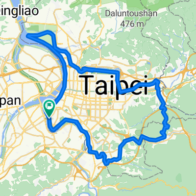
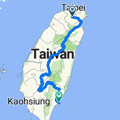
中央山脈一條鞭
A cycling route starting in Banqiao District, Taipei, Taiwan.
Overview
About this route
A whip in the central mountain range.
- -:--
- Duration
- 690.1 km
- Distance
- 8,446 m
- Ascent
- 8,466 m
- Descent
- ---
- Avg. speed
- ---
- Max. altitude
Continue with Bikemap
Use, edit, or download this cycling route
You would like to ride 中央山脈一條鞭 or customize it for your own trip? Here is what you can do with this Bikemap route:
Free features
- Save this route as favorite or in collections
- Copy & plan your own version of this route
- Split it into stages to create a multi-day tour
- Sync your route with Garmin or Wahoo
Premium features
Free trial for 3 days, or one-time payment. More about Bikemap Premium.
- Navigate this route on iOS & Android
- Export a GPX / KML file of this route
- Create your custom printout (try it for free)
- Download this route for offline navigation
Discover more Premium features.
Get Bikemap PremiumFrom our community
Other popular routes starting in Banqiao District
 板橋-觀音山
- Distance
- 22 km
- Ascent
- 413 m
- Descent
- 76 m
- Location
- Banqiao District, Taipei, Taiwan
 新店-北宜-礁溪
- Distance
- 61.1 km
- Ascent
- 2,514 m
- Descent
- 2,331 m
- Location
- Banqiao District, Taipei, Taiwan
 台北市一圈
台北市一圈- Distance
- 68.8 km
- Ascent
- 207 m
- Descent
- 211 m
- Location
- Banqiao District, Taipei, Taiwan
 西濱-八仙to白沙屯
- Distance
- 104.3 km
- Ascent
- 132 m
- Descent
- 133 m
- Location
- Banqiao District, Taipei, Taiwan
 碧潭-獅子頭山
- Distance
- 12.1 km
- Ascent
- 704 m
- Descent
- 80 m
- Location
- Banqiao District, Taipei, Taiwan
 中央山脈一條鞭
- Distance
- 690.1 km
- Ascent
- 8,446 m
- Descent
- 8,466 m
- Location
- Banqiao District, Taipei, Taiwan
 新北南環110
- Distance
- 64.7 km
- Ascent
- 209 m
- Descent
- 209 m
- Location
- Banqiao District, Taipei, Taiwan
 輪霸西濱200
- Distance
- 203.4 km
- Ascent
- 204 m
- Descent
- 203 m
- Location
- Banqiao District, Taipei, Taiwan
Open it in the app