

metro loop first via burnaby mountain
A cycling route starting in West Vancouver, British Columbia, Canada.
Overview
About this route
- -:--
- Duration
- 90.7 km
- Distance
- 1,205 m
- Ascent
- 1,214 m
- Descent
- ---
- Avg. speed
- 361 m
- Max. altitude
Route quality
Waytypes & surfaces along the route
Waytypes
Quiet road
24.7 km
(27 %)
Road
24.5 km
(27 %)
Surfaces
Paved
80.2 km
(88 %)
Unpaved
0.9 km
(1 %)
Asphalt
69.7 km
(77 %)
Paved (undefined)
7.7 km
(9 %)
Route highlights
Points of interest along the route
Point of interest after 0.6 km
Might as well start and finish somewhere central.
Point of interest after 15.2 km
You're now entering Burnaby.
Point of interest after 17 km
Still on this long, straight, undulating, rather boring bikeway.
Point of interest after 19.2 km
Through the park, take lungfuls of non-road air.
Point of interest after 20.9 km
Commence upward mobility.
Point of interest after 21.9 km
Obviously much busier in term-time. Big wide shoulder to ride on here though, no worries. Get into the steady climb.
Point of interest after 24.9 km
Try to ignore the tempting mtb trails sprouting off every 100 yards or so.
Point of interest after 26.3 km
At the heart of beautiful Arthur Erickson-designed SFU. A new university so no need for impromptu Latin orations.
Point of interest after 34.1 km
Unfortunately you now have to take back 100m of the height you just chucked away.
Point of interest after 35.6 km
Southeast Bikeway - Vancouver bikeways have prosaic names.
Point of interest after 52.5 km
Inhale the arousing odour of the so-called Punjabi market - really about three blocks of Indian / Pakistani restaurants and draperies.
Point of interest after 54.9 km
Chugging along 49th - traffic usually not bad.
Point of interest after 58.8 km
Rejoin Marine, now in its SW incarnation.
Point of interest after 61.1 km
Long, gradual climb up to UBC. Can be painful if you have a headwind.
Point of interest after 66.2 km
Agronomy Road, what an awesome name. Contemplate reaping and sowing.
Point of interest after 66.6 km
We're skirting UBC rather than penetrating its interior, because frankly we're just not smart enough. We feel overawed by all the donnish types conversing in Greek.
Point of interest after 67.3 km
You can stop and visit the museum if you like! It's worth a look.
Point of interest after 67.7 km
More fun to zoom down Marine than rumble down Chancellor.
Point of interest after 71 km
See people slouching and disporting on the beach in summertime.
Point of interest after 73.6 km
Can't stay away from those beaches!
Point of interest after 77.7 km
Brewery smells enticing or repulsive depending on your mood.
Point of interest after 78.4 km
It's not a ride in Vancouver without a bridge.
Continue with Bikemap
Use, edit, or download this cycling route
You would like to ride metro loop first via burnaby mountain or customize it for your own trip? Here is what you can do with this Bikemap route:
Free features
- Save this route as favorite or in collections
- Copy & plan your own version of this route
- Split it into stages to create a multi-day tour
- Sync your route with Garmin or Wahoo
Premium features
Free trial for 3 days, or one-time payment. More about Bikemap Premium.
- Navigate this route on iOS & Android
- Export a GPX / KML file of this route
- Create your custom printout (try it for free)
- Download this route for offline navigation
Discover more Premium features.
Get Bikemap PremiumFrom our community
Other popular routes starting in West Vancouver
 Cypress Bowl - Kill ATG!
- Distance
- 15.4 km
- Ascent
- 790 m
- Descent
- 48 m
- Location
- West Vancouver, British Columbia, Canada
 Cypress Climb
- Distance
- 14 km
- Ascent
- 888 m
- Descent
- 105 m
- Location
- West Vancouver, British Columbia, Canada
 metro loop first via burnaby mountain
- Distance
- 90.7 km
- Ascent
- 1,205 m
- Descent
- 1,214 m
- Location
- West Vancouver, British Columbia, Canada
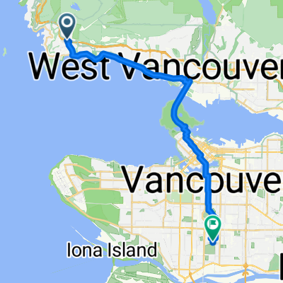 4749 Rutland Rd, West Vancouver to 100 W 49th Ave, Vancouver
- Distance
- 24.5 km
- Ascent
- 268 m
- Descent
- 343 m
- Location
- West Vancouver, British Columbia, Canada
 Dam Bur Van
- Distance
- 125.1 km
- Ascent
- 1,780 m
- Descent
- 1,782 m
- Location
- West Vancouver, British Columbia, Canada
 Seven Bridges
- Distance
- 78.8 km
- Ascent
- 589 m
- Descent
- 589 m
- Location
- West Vancouver, British Columbia, Canada
 Cypress
- Distance
- 15.7 km
- Ascent
- 744 m
- Descent
- 19 m
- Location
- West Vancouver, British Columbia, Canada
 Kurze Radrunde vom 28. September, 09:32
- Distance
- 3.3 km
- Ascent
- 805 m
- Descent
- 13 m
- Location
- West Vancouver, British Columbia, Canada
Open it in the app