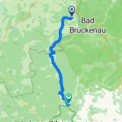
Altstadt 10, Bad Brückenau - Kreuzberg Kloster - Bischofsheim a.d. Rhön, Bischofsheim in der Rhön
- 25.7 km
- 980 m
- 442 m
- Bad Brückenau, Bavaria, Germany
A cycling route starting in Bad Brückenau, Bavaria, Germany.
Overview
created this 2 years ago
Route quality
Track
8.8 km
(34 %)
Path
7.5 km
(29 %)
Paved
13.6 km
(53 %)
Unpaved
11.1 km
(43 %)
Asphalt
13.6 km
(53 %)
Gravel
8.5 km
(33 %)
Continue with Bikemap
You would like to ride Altstadt 10, Bad Brückenau - Kreuzberg Kloster - Bischofsheim a.d. Rhön, Bischofsheim in der Rhön or customize it for your own trip? Here is what you can do with this Bikemap route:
Free trial for 3 days, or one-time payment. More about Bikemap Premium.
Discover more Premium features.
Get Bikemap PremiumFrom our community
Open it in the app