
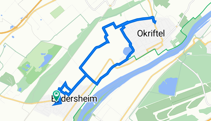
Anton-Flettner-Straße 20D, Hattersheim am Main nach Anton-Flettner-Straße 22D, Hattersheim am Main
A cycling route starting in Raunheim, Hesse, Germany.
Overview
About this route
- 54 min
- Duration
- 9.5 km
- Distance
- 36 m
- Ascent
- 24 m
- Descent
- 10.6 km/h
- Avg. speed
- 99 m
- Avg. speed
Route quality
Waytypes & surfaces along the route
Waytypes
Quiet road
3.6 km
(38 %)
Track
2.7 km
(29 %)
Surfaces
Paved
4.9 km
(51 %)
Unpaved
1.3 km
(14 %)
Asphalt
3.3 km
(35 %)
Gravel
0.7 km
(8 %)
Continue with Bikemap
Use, edit, or download this cycling route
You would like to ride Anton-Flettner-Straße 20D, Hattersheim am Main nach Anton-Flettner-Straße 22D, Hattersheim am Main or customize it for your own trip? Here is what you can do with this Bikemap route:
Free features
- Save this route as favorite or in collections
- Copy & plan your own version of this route
- Sync your route with Garmin or Wahoo
Premium features
Free trial for 3 days, or one-time payment. More about Bikemap Premium.
- Navigate this route on iOS & Android
- Export a GPX / KML file of this route
- Create your custom printout (try it for free)
- Download this route for offline navigation
Discover more Premium features.
Get Bikemap PremiumFrom our community
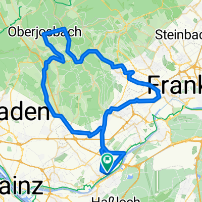
Other popular routes starting in Raunheim
 Raunheim-Kelsterbach-Flughafen-Walldorf-GG-Ried-Raunheim
- Distance
- 88.6 km
- Ascent
- 67 m
- Descent
- 69 m
- Location
- Raunheim, Hesse, Germany
 Rund um den Flughafen Frankfurt
- Distance
- 34.8 km
- Ascent
- 137 m
- Descent
- 138 m
- Location
- Raunheim, Hesse, Germany
 Inlineskaterunde
- Distance
- 4.6 km
- Ascent
- 23 m
- Descent
- 20 m
- Location
- Raunheim, Hesse, Germany
 Kleine einfache MTB Runde
- Distance
- 19.8 km
- Ascent
- 115 m
- Descent
- 115 m
- Location
- Raunheim, Hesse, Germany
 Schöne Ausfahrt
- Distance
- 69 km
- Ascent
- 644 m
- Descent
- 608 m
- Location
- Raunheim, Hesse, Germany
 Kleine Taunusrunde
- Distance
- 63.6 km
- Ascent
- 585 m
- Descent
- 584 m
- Location
- Raunheim, Hesse, Germany
 aeroporto a hotel
- Distance
- 11.3 km
- Ascent
- 74 m
- Descent
- 50 m
- Location
- Raunheim, Hesse, Germany
 flache RR-Runde - Terbur
- Distance
- 77.1 km
- Ascent
- 115 m
- Descent
- 101 m
- Location
- Raunheim, Hesse, Germany
Open it in the app