

Velomaritime Trip
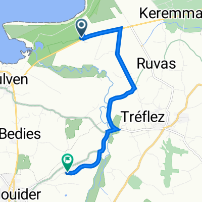
Jour 3: Plouider - Sibiril
A cycling route starting in Plouider, Brittany Region, France.
Overview
About this route
- -:--
- Duration
- 26.7 km
- Distance
- 160 m
- Ascent
- 154 m
- Descent
- ---
- Avg. speed
- 41 m
- Max. altitude

Part of
Velomaritime Trip
8 stages
Route quality
Waytypes & surfaces along the route
Waytypes
Quiet road
12 km
(45 %)
Road
8.8 km
(33 %)
Surfaces
Paved
4.3 km
(16 %)
Unpaved
0.3 km
(1 %)
Asphalt
4.3 km
(16 %)
Gravel
0.3 km
(1 %)
Undefined
22.2 km
(83 %)
Continue with Bikemap
Use, edit, or download this cycling route
You would like to ride Jour 3: Plouider - Sibiril or customize it for your own trip? Here is what you can do with this Bikemap route:
Free features
- Save this route as favorite or in collections
- Copy & plan your own version of this route
- Sync your route with Garmin or Wahoo
Premium features
Free trial for 3 days, or one-time payment. More about Bikemap Premium.
- Navigate this route on iOS & Android
- Export a GPX / KML file of this route
- Create your custom printout (try it for free)
- Download this route for offline navigation
Discover more Premium features.
Get Bikemap PremiumFrom our community
Other popular routes starting in Plouider
 ACGTP n°9045
- Distance
- 77 km
- Ascent
- 0 m
- Descent
- 0 m
- Location
- Plouider, Brittany Region, France
 Plouider 6
- Distance
- 24.3 km
- Ascent
- 245 m
- Descent
- 252 m
- Location
- Plouider, Brittany Region, France
 roscoff 1 36 km
- Distance
- 38.1 km
- Ascent
- 127 m
- Descent
- 126 m
- Location
- Plouider, Brittany Region, France
 De Lannévez 7, Tréflez à Pen ar Ménez 120, Plouider
- Distance
- 5.2 km
- Ascent
- 50 m
- Descent
- 17 m
- Location
- Plouider, Brittany Region, France
 Finisterra Gouarec
- Distance
- 178.3 km
- Ascent
- 926 m
- Descent
- 801 m
- Location
- Plouider, Brittany Region, France
 Za de Kerbiquet 22, Plouider to Za de Kerbiquet 22, Plouider
- Distance
- 14.5 km
- Ascent
- 163 m
- Descent
- 166 m
- Location
- Plouider, Brittany Region, France
 Itinéraire à partir de La Sablière 1, Tréflez
- Distance
- 5.2 km
- Ascent
- 25 m
- Descent
- 0 m
- Location
- Plouider, Brittany Region, France
 Jour 3: Plouider - Sibiril
- Distance
- 26.7 km
- Ascent
- 160 m
- Descent
- 154 m
- Location
- Plouider, Brittany Region, France
Open it in the app