

After Work Sonnenuntergangstour
A cycling route starting in Wiesenthau, Bavaria, Germany.
Overview
About this route
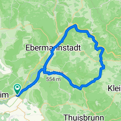
This great tour starts at Mühlenhofcafe, from here it goes via Wiesenthau, Schlaifhausen to the Walberla. From there you can enjoy the sunset and then cycle back to Mühlenhofcafe via Kirchehrenbach. Optionally, it is possible to end the day on the beautiful sun terrace at Hotel Ehrenbürg in Schlaifhausen or we can have a snack at the Lindenkeller or at Mühlenhof Cafe. This tour is not long but has steep gradients and is thus only suitable for experienced bikers. Worthwhile experience, highly recommended.
- -:--
- Duration
- 9.5 km
- Distance
- 284 m
- Ascent
- 273 m
- Descent
- ---
- Avg. speed
- ---
- Max. altitude
Continue with Bikemap
Use, edit, or download this cycling route
You would like to ride After Work Sonnenuntergangstour or customize it for your own trip? Here is what you can do with this Bikemap route:
Free features
- Save this route as favorite or in collections
- Copy & plan your own version of this route
- Sync your route with Garmin or Wahoo
Premium features
Free trial for 3 days, or one-time payment. More about Bikemap Premium.
- Navigate this route on iOS & Android
- Export a GPX / KML file of this route
- Create your custom printout (try it for free)
- Download this route for offline navigation
Discover more Premium features.
Get Bikemap PremiumFrom our community
Other popular routes starting in Wiesenthau
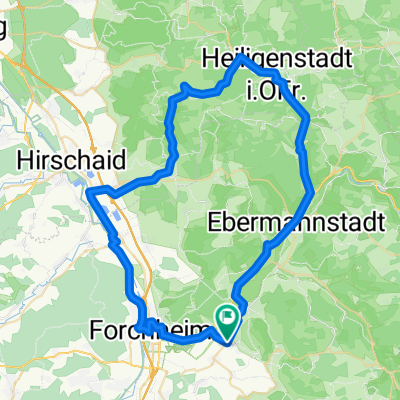
 Fränkische Schweiz ab Forchheim - Reuth
- Distance
- 51.2 km
- Ascent
- 731 m
- Descent
- 613 m
- Location
- Wiesenthau, Bavaria, Germany
 Durch die Bärenschlucht
- Distance
- 94.3 km
- Ascent
- 795 m
- Descent
- 793 m
- Location
- Wiesenthau, Bavaria, Germany
 Raubritter Tour
- Distance
- 30.9 km
- Ascent
- 496 m
- Descent
- 379 m
- Location
- Wiesenthau, Bavaria, Germany
 eine schöne kleine runde durch die fränkische CLONED FROM ROUTE 261440
- Distance
- 64.2 km
- Ascent
- 943 m
- Descent
- 943 m
- Location
- Wiesenthau, Bavaria, Germany
 Mühlenhof - Pretzfeld - Ebermannstadt - Mühlenhof
- Distance
- 19.5 km
- Ascent
- 65 m
- Descent
- 59 m
- Location
- Wiesenthau, Bavaria, Germany
 After Work Sonnenuntergangstour
- Distance
- 9.5 km
- Ascent
- 284 m
- Descent
- 273 m
- Location
- Wiesenthau, Bavaria, Germany
 Forchheim - Muggendorf - hängender Stein
- Distance
- 43.1 km
- Ascent
- 707 m
- Descent
- 684 m
- Location
- Wiesenthau, Bavaria, Germany
 Rundtour Wiesenthau - Glückstadt - Hirschaid
- Distance
- 61.1 km
- Ascent
- 334 m
- Descent
- 325 m
- Location
- Wiesenthau, Bavaria, Germany
Open it in the app